The history of climbing Kilimanjaro began long before the European expeditions. The peoples who lived on its slopes knew the mountain, its forests, its water and its dangers. The written European record of the nineteenth century captured only one stage of that history – reports of snow at the equator, scientific surveys, and the first documented arrival at the highest point of Kibo.
On 6 October 1889 the German geographer Hans Meyer and the Austrian mountaineer Ludwig Purtscheller reached the highest part of Kibo. Their expedition rested on a large African team, which carried the loads, supplied the high camps and made the route possible. Trekking today has become easier in technical terms, but it is still impossible without local guides, cooks and porters.
What is known for certain
- The first documented ascent of the highest summit of Kilimanjaro took place on 6 October 1889
- The highest point was reached by Hans Meyer and Ludwig Purtscheller
- The expedition depended on the work of an African team and on a network of high camps
- The modern name of the highest point is Uhuru Peak
- The height of Kilimanjaro is 5895m
- The national park was created in 1973
- In 1987 the park was added to the UNESCO World Heritage list
Before the written expeditions
Kilimanjaro was not “discovered” by Europeans in any human sense. The Chagga and other communities lived at its foot, used its water and its forests, saw the snow and passed on knowledge of the slopes. European discovery means the mountain’s appearance in one particular written and cartographic tradition.
Ancient descriptions of snowy mountains in East Africa are sometimes connected with Kilimanjaro, but it is hard to prove which mountain is meant. The formulation “Ptolemy was the first to describe Kilimanjaro” is therefore too confident. It turns a hypothesis into a fact.
Nor does the origin of the name have a single confirmed reading. The popular translations “shining mountain”, “white mountain” and other versions are repeated in guidebooks, but linguists and historians disagree. It is more honest to keep the uncertainty.
A modern account should include local societies not as a backdrop for a foreign hero, but as holders of knowledge and as the workers on the expeditions. Without them the early ascents would have been impossible.
Johannes Rebmann’s report
In 1848 the German missionary Johannes Rebmann reported a snow-covered mountain in East Africa. To European geography of the day, snow almost at the equator sounded implausible, and the report met with scepticism.
The doubt was not caused by any absence of local knowledge but by what European scholars believed about climate. Later travellers confirmed the existence of a large volcanic massif with a snow-covered summit.
Karl Klaus von der Decken and the geologist Richard Thornton surveyed the area in the 1860s. Charles New got higher up the slopes and reached the snow. These expeditions extended the cartographic and natural-history record.
Their routes, their equipment and their political context were all different from present-day tourism. Comparing days and altitudes directly calls for care: measurements, names and the state of the glaciers have all changed.
Hans Meyer’s first attempts
Hans Meyer first tried to climb Kibo in 1887. He reached the edge of the ice, but had neither the equipment nor the experience for hard ice. Turning back gave him information for the next attempt.
The 1888 attempt was broken off by political events and violence in the region. It is a reminder that the history of these expeditions depends not only on the mountain but on the colonial context of East Africa.
By 1889 Meyer had changed his approach. The expedition established several camps and caches at altitude so as not to descend far after each attempt. That logistical decision proved decisive.
The team included Ludwig Purtscheller, one of the strongest mountaineers of his day. His experience on ice complemented Meyer’s geographical aims.
6 October 1889
The first attempt in early October came to a halt after heavy work on an ice slope. A few days later Meyer and Purtscheller set out again and on 6 October reached the highest part of the crater rim of Kibo.
Conditions were nothing like today’s. The ice cap was considerably larger, the route meant cutting steps, and there was no made path and no camp infrastructure. Clothing, footwear and communications bear no comparison with the present.
Meyer’s book Across East African Glaciers, published in 1891, became the primary written source on the expedition. It has to be read critically, with the period and the author’s position in mind, but it preserves the detail of how the climb was organised and where it went.
The historical achievement does not belong to the two men in the photograph alone. The high camps were supplied by an African team. The sources mention Mwini Amani, who worked at the high camps, cooked, and brought up water and fuel.
The African team and the problem of memory
Colonial reports often described the European leaders in detail and recorded the names of local participants far less well. That is why the popular version of the story long presented the ascent as the achievement of two men.
A modern account has to acknowledge the work of the porters, guides and cooks, even where the archive has not preserved a full list. The gaps should not be made good with invented biographies or confident names for which there is no source.
The story of Yohani Kinyala Lauwo often appears in tourist material as the story of the local guide on the first ascent. Researchers have questioned the accuracy of the identification and of the dates. Mountain Guide therefore does not present the disputed version as an established fact.
The more dependable conclusion is a simple one: the expedition was a collective effort and depended on local workers. The same dependence holds today, although the roles and the rules have become more formal.
From a colonial name to Uhuru Peak
Meyer gave the point he reached a name connected with the German emperor. In the colonial period European expeditions freely attached the names of their own rulers and scholars to summits, in spite of the local geography that already existed.
After Tanzanian independence the highest point was named Uhuru Peak. The word uhuru means freedom in Swahili. The name ties the summit to the country’s national history rather than to a colonial monarchy.
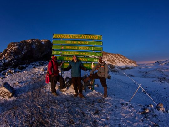
Today it is Uhuru Peak at 5895m that is the objective of the standard trekking routes. Stella Point and Gilman’s Point are on the crater rim, but they are not the highest point of the massif.
That distinction matters to anyone going. Reaching an intermediate point can be a considerable personal achievement, but a website should not pass it off as the summit of Kilimanjaro.
Kibo, Mawenzi and Shira
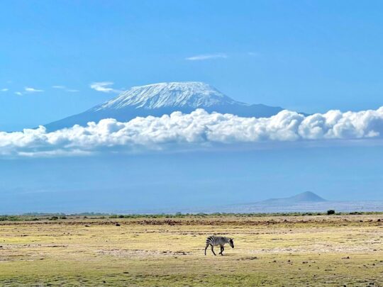
Kilimanjaro consists of three main volcanic centres: Kibo, Mawenzi and Shira. Kibo holds the highest point and is regarded as dormant. Mawenzi is more broken and more technical ground. Shira has been heavily eroded.
Today’s trekking routes go round different sides of Kibo and show these parts of the massif from different angles. Lemosho and the Northern Circuit start from the western plateaus, Machame comes in from the south, Rongai from the north, Marangu from the south-east.
Technical climbs on Mawenzi are not part of an ordinary Uhuru Peak programme. They call for separate permits, skills and support. Mentioning three volcanoes does not mean all three can be climbed on one trip.
The shape of the massif helps explain why there is no single “Kilimanjaro route”. The various paths join up nearer the summit, but they give different acclimatisation and a different experience.
The creation of the national park
Kilimanjaro was given national park status in 1973. The protected area originally took in the mountain above the tree line together with a number of forest corridors. The boundaries were later extended to give the mountain forest better protection.
In 1987 Kilimanjaro was added to the UNESCO World Heritage list. The organisation notes the highest summit in Africa, a large isolated volcanic massif, the glaciers and the succession of natural zones.
A climb today takes place under the park’s rules. Registration, the official team, the camps, the fees and the routes are all regulated. Going up independently, outside an approved arrangement, is not possible.
Conservation has to contend with the pressure of tourism, with fires, with pressure on the forest and with the retreat of the glaciers. Each person is responsible for their rubbish, their water and their compliance with the rules, and the operator for organising the team and the permits.
How modern trekking came about
The development of paths, camps and a local industry made Kilimanjaro accessible to fit people without demanding mountaineering experience. The altitude, however, has not gone anywhere. Technical simplicity does not mean physiological ease.
The Marangu route became known for its huts and its approach from the south-east. Machame developed the popular tented format with its leg out to Barranco. Lemosho uses the western approach, Rongai the northern one, and the Northern Circuit takes the long way round.
Short programmes found a market because of holiday allowances and price, but human acclimatisation has not speeded up. Safety today requires enough days, proper observation and a readiness to go down.
A comparison of the Kilimanjaro routes helps you choose a modern programme on its profile rather than on its historical fame.
The glaciers then and now
The 1889 expedition worked on far more extensive ice. Photographs today show a severe retreat of the glaciers. UNESCO explicitly calls them vulnerable to global climate change.
No one can promise an exact year for the disappearance of the ice: scientific models give ranges, and individual ice bodies behave differently. But the direction of travel is plain and is documented.
No visitor should approach a glacier off the permitted route for the sake of a photograph. A fragile high-mountain landscape and personal safety matter more than recreating an old picture.
The history of the ice makes Kilimanjaro not only a sporting objective but a place where climate change can be observed. That adds to the responsibility; it is not an advertisement for getting there at any cost.
The Seven Summits
Kilimanjaro entered the international Seven Summits list as the highest point in Africa. That has brought to the mountain people who are working through a long mountaineering plan continent by continent.
In technical terms the standard Kilimanjaro routes are easier than many of the summits on that list. In terms of altitude and the risk of altitude sickness the undertaking remains a serious one. Success here is no confirmation that you are ready for technical ice or for the extreme cold of other continents.
For Mountain Guide, Kilimanjaro can be a first step towards Elbrus, Aconcagua and further high-altitude programmes. Its value lies in the experience of several days at altitude, of a daily routine and of working with a team.
The next objective is chosen after looking at how you felt and what you achieved, not automatically. Even a successful summit can bring problems with footwear, cold or acclimatisation to light.
What has changed, and what has not
Equipment, maps, forecasts, communications and infrastructure have all changed. Someone going today has a light waterproof shell, a warm sleeping bag, satellite communications for the team and medical protocols that were not available to nineteenth-century expeditions.
What has not changed is the altitude, the cold, the need to walk on your own two feet, and the dependence on a team. A mountain does not become safe because it is popular and photographed on social media.
The collective character of the climb has not changed either. Tents, food, water and loads are organised by people. Respect for their work is part of the modern ethic.
Studying the history helps get rid of two extremes: the myth of an easy stroll, and the romanticising of suffering. Kilimanjaro is within reach of a prepared person on a professionally organised programme.
How to read the historical sources
A primary source shows how someone writing at the time saw things. Meyer’s book is useful for its detail, but it carries the language and the values of the colonial era. It cannot simply be copied across as a neutral modern truth.
Later tourist retellings often simplify names, dates and the meaning of the mountain’s name. Several websites repeating one fact do not make it more reliable if they are all drawing on the same unverified text.
For the key dates it is worth setting the primary report, archive reference works and the park’s or UNESCO’s official material side by side. Disputed details should be labelled as such.
That is why Mountain Guide has removed the confident translations of the name and the disputed assertions from the old version of this article. Expertise begins at the boundary of what is known.
History in a modern programme
What you walk is not Meyer’s route literally, but one of the official modern routes. The camps, the gates and the rules are different. A historical date is no substitute for a day-by-day programme.
Before choosing, look at the main Kilimanjaro page, compare the lengths and the accommodation, and then take stock of your own preparation. An interest in the history ought to lead to a better-informed choice.
If a private format matters to you, it is agreed separately. A team of your own gives you attention and dates of your own choosing, but it does not exempt you from local rules and it does not guarantee the summit.
After the mountain you can carry on with a safari or with Zanzibar. That way an interest in the history of Kilimanjaro becomes part of getting to know Tanzania more widely.
Chronology
- 1848 – Johannes Rebmann reports a snow-covered mountain to a European audience
- The 1860s – later expeditions confirm and survey the massif
- 1887 – Hans Meyer reaches the edge of the ice and turns back
- 1889 – Meyer and Purtscheller reach the highest part of Kibo
- After independence – the highest point is named Uhuru Peak
- 1973 – Kilimanjaro National Park is created
- 1987 – the park is added to the UNESCO World Heritage list
- 2005 – the protected area is extended to take in mountain forest
Frequently asked questions
Who was the first to climb Kilimanjaro?
The first documented arrival at the highest summit belongs to Hans Meyer and Ludwig Purtscheller in 1889, with decisive support from the African expedition team.
Who discovered Kilimanjaro?
Local peoples knew the mountain long before Europeans did. Rebmann was the first to report it widely to a European audience, in 1848.
What does the name Kilimanjaro mean?
There is no single proven reading. The popular translations are versions, not established fact.
Why is the summit called Uhuru?
Uhuru means freedom in Swahili. The modern name is connected with Tanzanian independence.
Walk your own chapter of Kilimanjaro’s history
Choose the route, the dates and the form of support together with Mountain Guide. We connect a historic mountain with a modern programme, proper preparation and honest terms.
Sources and date checked
This material was checked and fully updated on 4 August 2026.
- Hans Meyer – Across East African Glaciers, 1891
- UNESCO – Kilimanjaro National Park
- TANAPA – the official Kilimanjaro reference guide
Kilimanjaro routes