- Guides
- B2B
-
#19607 (no title)
-
#15972 (no title)
- Climb Elbrus Individually
- Climb Elbrus from the South, 9 Days
- Climb Elbrus from the South, 7 Days
- Climb Elbrus from the South with Oxygen
- Climb Elbrus from the North, 10 Days
- Two Summits of Elbrus, 9 Days
- Elbrus Traverse from South to North, 9 Days
- Elbrus Traverse from North to South, 10 Days
- Cross of Elbrus, South to North, 9 Days
- Cross of Elbrus, North to South, 10 Days
- Climb Kazbek and Elbrus — 10-Day Two-Summit Expedition
- Climb Elbrus from the West, 11 Days
- Elbrus by Private Helicopter, 3 Days
- Elbrus Region Holiday and Trekking, 9 Days
- Elbrus Region Holiday, 7 Days
- Elbrus Dating
- Climb Elbrus from the South, 9 Days with Sergey Baranov
-
#15539 (no title)
- Climb Carstensz Pyramid, 8 Days with Helicopter Access
- Climb Mont Blanc, 4810 m — 8-Day Guided Ascent
- Climb the Matterhorn, 4478 m — 8-Day Guided Ascent
- Climb Mount Vinson, 15-Day Antarctic Expedition
- Climb Kosciuszko and Travel in Australia, 7 Days
- Climb Fisht, 2868 m — 3-Day Ascent by the 1B Route
- Climb Mount Wilhelm, 6 Days
-
#15546 (no title)
- Climb Kilimanjaro: the Marangu Route
- Climb Kilimanjaro: the Lemosho Route
- Climb Ararat, 5137 m — 7-Day Classic Climb
- Climb Kazbek from the South, 5033 m — 8 Days in Georgia
- Climb Kazbek and Elbrus — 10-Day Two-Summit Expedition
- Climb the Volcanoes of Mexico — Orizaba and Iztaccíhuatl, 9 Days
- Climb Alpamayo — 16-Day Technical Expedition
- Climb Margaret Peak (Stanley), 5109 m
- Climb Mount Kenya: Point Lenana, 4985 m
- Climb Dykh-Tau by the North Ridge, 13 Days
-
#15554 (no title)
- Aconcagua Climb — 17-Day Guided Expedition
- Island Peak Climb — 18-Day Expedition
- Climb Mera Peak, 6476 m — 16-Day Hinku Valley Expedition
- Climb Ama Dablam, 6812 m — 24-Day Expedition with Island Peak
- Climb Island Peak and Mera Peak — 24-Day Two-Summit Expedition
- Aconcagua and Ojos del Salado — 25-Day Combined Expedition
- Ojos del Salado Climb — 15-Day Expedition
- Climb Chimborazo and Cotopaxi — 14-Day Ecuador Expedition
- Climb Huascarán — 8-Day Technical Ascent
- Climb Razdelnaya Peak, 6148 m — 15-Day Pamir Expedition
- Climb Denali by the West Buttress, 23 Days
- #15565 (no title)
- #15572 (no title)
-
#15972 (no title)
-
#19592 (no title)
-
Trekking in Nepal: routes to the eight-thousanders
- K2 Base Camp Trek via the Gondogoro La
- Everest Base Camp Trek — 14 Days
- Everest Base Camp via Gokyo Lakes — 15 Days
- Short Everest Base Camp Trek in 10 Days
- Annapurna Circuit and Tilicho Lake Trek
- Manaslu Circuit Trek
- Kanchenjunga Circuit Trek (XXL)
- Kanchenjunga North Base Camp Trek (Short)
- Kanchenjunga from India: the Goecha La Trek in Sikkim
- Makalu Base Camp Trek
- Annapurna Base Camp Trek
- Trekking in South America
- Asia
- Trekking in Africa
-
Trekking in Russia
- Elbrus Region Holiday and Trekking, 9 Days
- Elbrus Region Holiday, 7 Days
- Oshten + Kardyvach — 9-Day Western Caucasus Trek
- Lake Kardyvach — 5-Day Base-Camp Trek
- Route 30: Through the Mountains to the Sea, with Oshten — 4 Days
- Trekking in Arkhyz — 7 Days over the Ayulyu Pass
- Gvandra Trek — 7 Days to the Ullu-Kyol Lakes
- Trekking in Dombai — 7 Days with the Murudzhu Lakes
- Europe
-
Trekking in Nepal: routes to the eight-thousanders
-
Adventure expeditions
-
Trekking in Africa
- モロッコツアー:北アフリカの中心
- トゥブカルの登山とモロッコの文化
- Eritrea: the Dahlak Archipelago and the Rashaida Nomads
- Rwanda: Mountain Gorillas and the Bisoke Volcano
- Ethiopia: Otherworldly Landscapes and the Peoples of the Omo Valley
- ウガンダツアー:クイーンズパークとマウンテンゴリラ
- Tanzania Safari: Serengeti, Ngorongoro and Tarangire
- ウガンダツアー:ホワイトサイとマウンテンゴリラ
- Zimbabwe and South Africa: Victoria Falls, Cape Town and the Cape of Good Hope
- Namibia: Etosha National Park and the Himba
- Kenya Safari: the African Big Five
- ボツワナツアー:オカバンゴデルタとチョベ公園
- Trekking in South America
- Asia
-
Trekking in Africa
- Ski touring and ski mountaineering: chasing freedom in the mountains
- VIP tours
- #19722 (no title)
- About
Route 30: Through the Mountains to the Sea, with Oshten — 4 Days
- Height (m)
- 2804
- Duration
- 4 days
- Difficulty
- Low
- Continent
- Europe
- Children
- Ages 8+
- Accommodation
- Some nights in tents
420 $
Why to go with us?
Temporarily unavailable
Route 30, «Through the mountains to the sea», in its compact four-day version. The trip runs from Krasnodar across the Lagonaki plateau and over the Guzeripl, Armenian, Belorechensky and Cherkessky passes to Babuk-Aul, and finishes with a transfer to Sochi. An out-and-back ascent of Oshten, 2804 m, is part of the trip.
Programme price — $420.
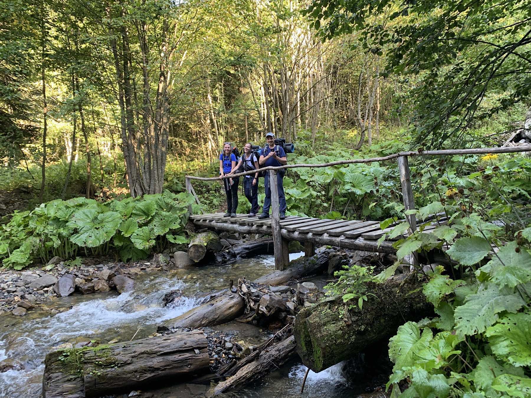
This is a short but full walking trip with tents, a loaded pack and a sharp change of natural zones. It suits active beginners who are ready for long days on the trail and who want to cross part of the Main Caucasus Range for the first time with a guide.
Families can take part with children from 2 years old, provided a fit adult carries the child in a child-carrier pack. Because the four-day schedule is compact, the adult should assess the total weight and their readiness to walk the route without an extra rest day well in advance.
Important
- This page sells the four-day version of the route — not the historic two-week route and not the nature reserve's full five-day scheme
- Access to the route depends on the official opening by the Caucasus Nature Reserve
- The out-and-back ascent of Oshten is made only in suitable weather and with the group in suitable condition
About Route 30, through the mountains to the sea
«The Thirty» is the historic name of an All-Union tourist route. It is not a statement about the number of kilometres or the number of days. Modern versions differ in length and in starting point. This trip runs one specific four-day trip: one night in Krasnodar, two walking days with tents in the area of the Fisht shelter, and a finish in Sochi.
After the drive to Yavorovaya Polyana the group crosses the Guzeripl and Armenian passes to the Fisht shelter. On the third day there is an out-and-back ascent of Oshten, made without moving the main camp. On the final day the route crosses the Belorechensky and Cherkessky passes and descends to Babuk-Aul, from where participants transfer to the coast.
No technical mountaineering experience is required, but the compact schedule makes the trip physically dense. You need to be ready to walk a mountain trail with a pack, to cope with changeable weather and to recover in a tent. Early in the season snowfields may still lie on the approaches to Oshten, and the guide confirms the personal equipment list.
Before the trip it is worth reading through our guidance on choosing trekking footwear, our overview of guided treks and the entry level of our mountain training plan.
Route 30 trekking itinerary, 4 days
Day 1. Participants gather at the hotel in Krasnodar. Equipment check and a group briefing. Night at the hotel. It is also possible to join the group in Maykop or in Guzeripl.
Day 2. An early departure for the start of the route at Yavorovaya Polyana, 100 km from Maykop. The drive passes through fine scenery. Today’s walking distance is 10 km. It begins with a long but gentle climb to the Guzeripl pass, 2043 m above sea level, which gives a striking view: the Kamennoye More ridge rises ahead, the sheer walls of Oshten stand to the right, and a little to the left are the main Caucasus range and Mount Fisht. The trail then descends along the walls of Oshten to the Armenian pass at 1865 m, with an equally fine view of Fisht and the neighbouring ridges. The Fisht shelter is visible from the pass, on a picturesque clearing at the foot of the mountain, and only about 30 minutes away. On arrival the group chooses a suitable place, pitches the tents and settles in for dinner and rest. Night in tents.
Day 3. An early start. The plan for the day is an out-and-back ascent of Oshten, 2804 m. The group rises early, has breakfast and takes some food for a snack before setting out. The ascent of Oshten needs no special skills and can be walked. The route starts across the alpine slopes of Mount Blyam, next to Oshten. From the top of Blyam a fine panorama of the area opens up and the onward line to the summit becomes clear. The ground underfoot changes markedly with the season: in early summer snow cover still remains, melting away by midsummer and sometimes only by the end of it. The grassy slopes of Oshten, like the whole surrounding area, are striking for the variety of the local flora. On reaching the pre-summit ridge the first thing to draw the eye is the highest peak of the whole massif, Mount Fisht, 2868 m. On the pre-summit plateau the view widens: the Fisht massif, the slopes of Pshekha-Su, the valley of the Belaya river and the Fisht shelter are all clearly visible. From the summit itself a panorama of the entire Lago-Naki plateau opens up.
Day 4. In the morning the group heads for the shepherds’ huts near the Cherkessky pass. Leaving the shelter, the trail climbs gently towards the Belorechensky pass, 1782 m above sea level. Most of the route passes through forest, but nearer the top the forest gives way to crooked woodland and then disappears altogether. From the pass there is a fine panorama of the Belaya river valley, the slopes of Oshten, the Armenian ridge and Mount Fisht. The route then runs along the walls of Fisht to the Cherkessky pass at 1836 m. What follows is the liveliest part of the route: 4 km of very steep descent, known among walkers as the «merry descent». Beyond it the trail reaches a dirt road leading to the Babuk-Aul shelter, from where a truck takes the group to Solokh-Aul and a comfortable transfer continues to Sochi, in the Adler district.
What's included
- Accommodation in twin or triple rooms at a hotel in Krasnodar — 1 night
- The work of the guide
- Transfer Krasnodar — Yavorovaya Polyana
- Transfer Solokh-Aul — Sochi
- Nature reserve permit
- Three meals a day of mountain type on the route, from day 2 to day 4
- Group equipment: tents, navigator, cooking equipment, gas, first-aid kit and similar items
What's not included
- Travel from Sochi
- Personal equipment
- Any departure from the itinerary
- Accommodation and dinner in Sochi
- Any costs arising from a change to the itinerary
Route 30 for private groups
The four-day trip can be arranged for a group of friends, a walking club or a corporate group on its own dates, once the route has officially opened.
A private group can discuss an extra day, a separate transfer and a gentler pace. The full five-day version, or any other variant of the “Thirty”, is arranged as a separate trip with its own quote.
For a child aged 2 or over you need a carrier pack and an adult prepared to carry the extra weight. Deuter child carriers can be reserved in advance from Rock and Rent. If a family wants a gentler pace, it is best to quote the private trip with an extra day from the outset.
Documents required for Route 30
To join this trip you will need:
- A valid passport
- Tickets to Krasnodar and from Sochi, according to your own travel arrangements
- Medical insurance covering mountain trekking and the maximum altitude of the trip, at least 2804 m
- The details needed for a Caucasus Nature Reserve permit
- Digital copies of your main documents, saved on your phone and in cloud storage
The nature reserve permit is included in the price of the trip. The organiser will tell you the deadline for supplying your details before departure.
Weather and season on Route 30
The Caucasus Nature Reserve normally opens Route 30 once the passes are clear of continuous snow cover; as a rule the season runs from June to September. The exact opening and closing dates are published separately and take precedence over the tour calendar.
Early in the season, patches of snow can remain on the route. In summer you can meet rain, thunderstorms, mist and strong wind, and on the passes it is markedly colder than in Krasnodar or Sochi. In autumn, night frosts and short-lived snow become more likely.
Your guide may cancel the outing to Oshten or change the start time if conditions are unsafe. The reserve opening the route does not mean that every out-and-back summit is accessible in any weather.
Accommodation and meals on Route 30
On the first day the group stays in a hotel in Krasnodar, in twin or triple rooms. On the mountain section the nights are spent under canvas near the Fisht hut. Accommodation in Sochi after the route ends is not included in the price.
The price includes three meals a day on the route, from the second day to the fourth. At the tented camp the food is cooked in a group kitchen; participants help with water and with the running of the camp.
Dietary restrictions and allergies must be reported in advance, before the food is planned and bought.
Day-to-day conditions on Route 30
Once on the route the group lives under canvas. There may be basic visitor facilities near the hut, but you cannot count on a hotel shower, reliable electricity or continuous internet.
You need a power bank, a head torch with spare batteries, your own toiletries and rain protection for your kit. There is no mobile signal on some sections.
Participants carry their own equipment and a share of the group load, pitch the tents and help keep the camp running. On the day of the out-and-back outing to Oshten, the main load stays at the hut.
Insurance
НаверхEquipment list for the Route 30 trek
Скачать PDFDocuments:
- Passport
- Air or rail tickets
- Medical insurance
Personal equipment:
- Rucksack. 50-60 litres
- Sleeping bag with a comfort rating of 0 to -7 °C
- Foam sleeping mat
- Trekking poles
- Crampons
- Ice axe. Classic
- Climbing harness
- Karabiners – 2
- Cow’s-tail lanyards
- Mountaineering or high-altitude boots
- Trainers
- Waterproof shell: jacket and trousers. The industry offers a whole range of products, from simple membranes at
- 5,000/5,000 up to garments made from Gore-Tex
- Fleece top and bottoms
- Base layer, top and bottoms
- Down jacket with a hood
- Fleece gloves
- Bandana (as well as sun protection in the valley, it can keep your throat or face warm in the cold)
- Warm hat
- Socks
- Helmet
Other items:
- LED head torch with at least 12 hours of battery life
- Sunglasses
- Vacuum flask, 1 litre. Preferably without a push-button lid
- Windproof face mask for the lower face (a scarf will do at a pinch)
- Gaiters
- Sun cream and lip balm
- Chemical hand warmers (not compulsory, but they can be very useful)
- Personal first-aid kit
- Elastic bandage and/or a support brace
- Mug, spoon, bowl and knife