- Guides
- B2B
-
#19607 (no title)
-
#15972 (no title)
- Climb Elbrus Individually
- Climb Elbrus from the South, 9 Days
- Climb Elbrus from the South, 7 Days
- Climb Elbrus from the South with Oxygen
- Climb Elbrus from the North, 10 Days
- Two Summits of Elbrus, 9 Days
- Elbrus Traverse from South to North, 9 Days
- Elbrus Traverse from North to South, 10 Days
- Cross of Elbrus, South to North, 9 Days
- Cross of Elbrus, North to South, 10 Days
- Climb Kazbek and Elbrus — 10-Day Two-Summit Expedition
- Climb Elbrus from the West, 11 Days
- Elbrus by Private Helicopter, 3 Days
- Elbrus Region Holiday and Trekking, 9 Days
- Elbrus Region Holiday, 7 Days
- Elbrus Dating
- Climb Elbrus from the South, 9 Days with Sergey Baranov
-
#15539 (no title)
- Climb Carstensz Pyramid, 8 Days with Helicopter Access
- Climb Mont Blanc, 4810 m — 8-Day Guided Ascent
- Climb the Matterhorn, 4478 m — 8-Day Guided Ascent
- Climb Mount Vinson, 15-Day Antarctic Expedition
- Climb Kosciuszko and Travel in Australia, 7 Days
- Climb Fisht, 2868 m — 3-Day Ascent by the 1B Route
- Climb Mount Wilhelm, 6 Days
-
#15546 (no title)
- Climb Kilimanjaro: the Marangu Route
- Climb Kilimanjaro: the Lemosho Route
- Climb Ararat, 5137 m — 7-Day Classic Climb
- Climb Kazbek from the South, 5033 m — 8 Days in Georgia
- Climb Kazbek and Elbrus — 10-Day Two-Summit Expedition
- Climb the Volcanoes of Mexico — Orizaba and Iztaccíhuatl, 9 Days
- Climb Alpamayo — 16-Day Technical Expedition
- Climb Margaret Peak (Stanley), 5109 m
- Climb Mount Kenya: Point Lenana, 4985 m
- Climb Dykh-Tau by the North Ridge, 13 Days
-
#15554 (no title)
- Aconcagua Climb — 17-Day Guided Expedition
- Island Peak Climb — 18-Day Expedition
- Climb Mera Peak, 6476 m — 16-Day Hinku Valley Expedition
- Climb Ama Dablam, 6812 m — 24-Day Expedition with Island Peak
- Climb Island Peak and Mera Peak — 24-Day Two-Summit Expedition
- Aconcagua and Ojos del Salado — 25-Day Combined Expedition
- Ojos del Salado Climb — 15-Day Expedition
- Climb Chimborazo and Cotopaxi — 14-Day Ecuador Expedition
- Climb Huascarán — 8-Day Technical Ascent
- Climb Razdelnaya Peak, 6148 m — 15-Day Pamir Expedition
- Climb Denali by the West Buttress, 23 Days
- #15565 (no title)
- #15572 (no title)
-
#15972 (no title)
-
#19592 (no title)
-
Trekking in Nepal: routes to the eight-thousanders
- K2 Base Camp Trek via the Gondogoro La
- Everest Base Camp Trek — 14 Days
- Everest Base Camp via Gokyo Lakes — 15 Days
- Short Everest Base Camp Trek in 10 Days
- Annapurna Circuit and Tilicho Lake Trek
- Manaslu Circuit Trek
- Kanchenjunga Circuit Trek (XXL)
- Kanchenjunga North Base Camp Trek (Short)
- Kanchenjunga from India: the Goecha La Trek in Sikkim
- Makalu Base Camp Trek
- Annapurna Base Camp Trek
- Trekking in South America
- Asia
- Trekking in Africa
-
Trekking in Russia
- Elbrus Region Holiday and Trekking, 9 Days
- Elbrus Region Holiday, 7 Days
- Oshten + Kardyvach — 9-Day Western Caucasus Trek
- Lake Kardyvach — 5-Day Base-Camp Trek
- Route 30: Through the Mountains to the Sea, with Oshten — 4 Days
- Trekking in Arkhyz — 7 Days over the Ayulyu Pass
- Gvandra Trek — 7 Days to the Ullu-Kyol Lakes
- Trekking in Dombai — 7 Days with the Murudzhu Lakes
- Europe
-
Trekking in Nepal: routes to the eight-thousanders
-
Adventure expeditions
-
Trekking in Africa
- モロッコツアー:北アフリカの中心
- トゥブカルの登山とモロッコの文化
- Eritrea: the Dahlak Archipelago and the Rashaida Nomads
- Rwanda: Mountain Gorillas and the Bisoke Volcano
- Ethiopia: Otherworldly Landscapes and the Peoples of the Omo Valley
- ウガンダツアー:クイーンズパークとマウンテンゴリラ
- Tanzania Safari: Serengeti, Ngorongoro and Tarangire
- ウガンダツアー:ホワイトサイとマウンテンゴリラ
- Zimbabwe and South Africa: Victoria Falls, Cape Town and the Cape of Good Hope
- Namibia: Etosha National Park and the Himba
- Kenya Safari: the African Big Five
- ボツワナツアー:オカバンゴデルタとチョベ公園
- Trekking in South America
- Asia
-
Trekking in Africa
- Ski touring and ski mountaineering: chasing freedom in the mountains
- VIP tours
- #19722 (no title)
- About
Kanchenjunga Circuit Trek (XXL)
- Height (m)
- 5136, 5947
- Duration
- 19 days
- Difficulty
- Moderate
- Continent
- Asia
- Children
- Ages 14+
- Accommodation
- No nights in tents
1600 $
Why to go with us?
Temporarily unavailable
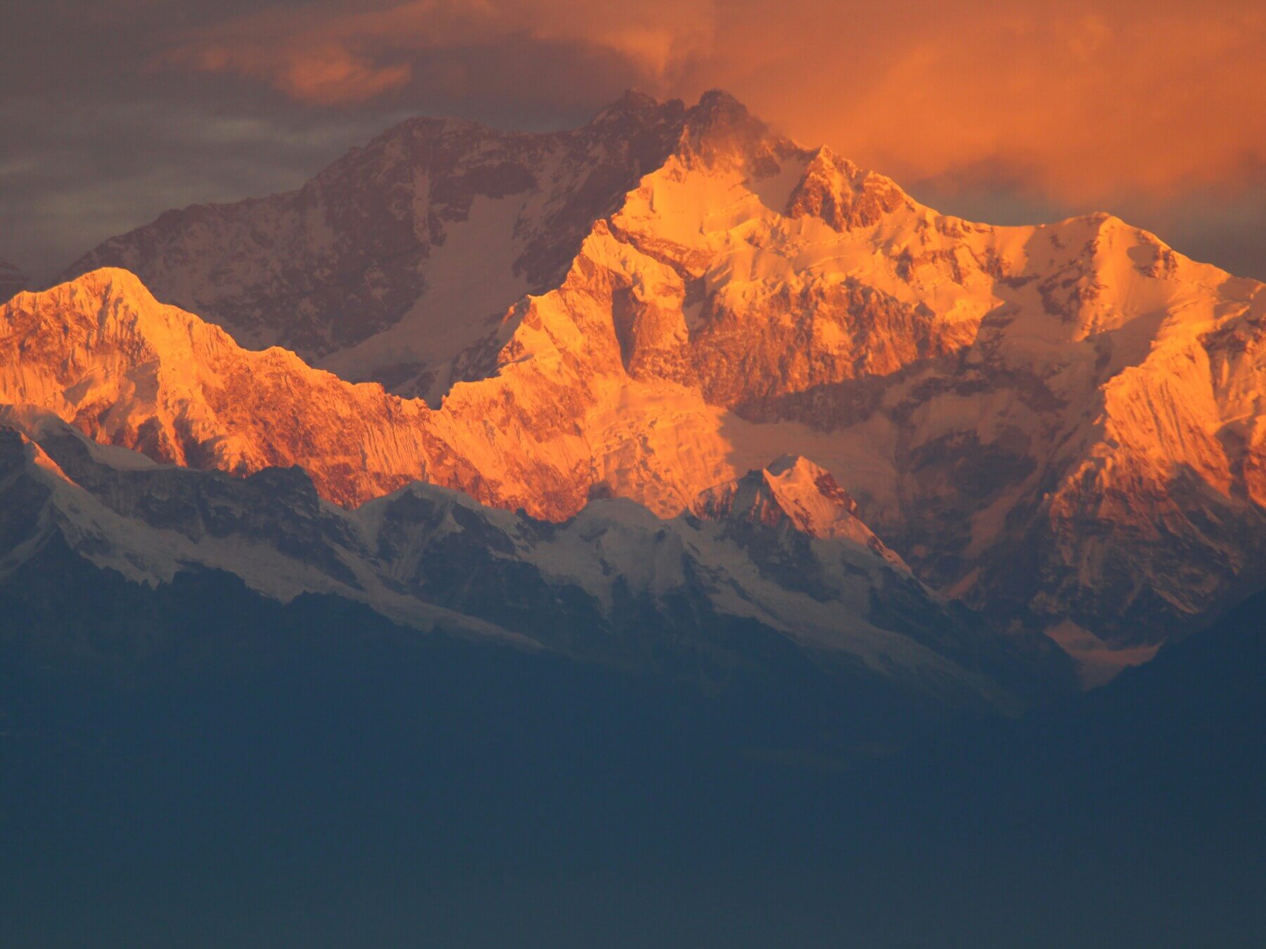
The Kanchenjunga circuit trek is a nineteen-day route in one of the most remote districts of eastern Nepal. The group climbs through Ghunsa and Kambachen to the northern base camp at Pangpema, then crosses a series of high passes and reaches the Yalung Glacier on the southern side of the massif.
- Pangpema northern base camp, 5388 m
- Lhonak, 4800 m, and an acclimatisation day in Kambachen
- The Sele La, Sinion La, Mirgin La and Sinelapche Bhanjyang passes
- An out-and-back walk to the Yalung Glacier via Ramche and Oktang
- Forests, moraines and high valleys without mass tourism
- Both the long northern and southern sections in one trip
- A Mountain Guide team leader with groups of four participants or more
- A Nepali guide for groups of up to three participants
This is a route for experienced trekkers. Participants need good endurance and a readiness for several long days in succession, simple lodges and a night at base camp. A possible outing to about 5900 m is made only in confirmed conditions, with suitable equipment and at the guide's decision.
The trip price is fixed in US dollars.
Important
- International and domestic flights, meals on the trek, a personal porter, the visa and insurance are paid separately
- Whether the jeep transfers between Bhadrapur, Taplejung and the start of the trek are included must be confirmed before booking
- The high-altitude outing to about 5900 m is not guaranteed; the exact objective and the equipment requirements are confirmed separately
- The state of the passes and of the landslide-prone sections may change the trip
- Mountain Guide does not sell air tickets and does not arrange visas
About the Kanchenjunga circuit trek
Kanchenjunga stands on the border of Nepal and India and is the third-highest mountain in the world. The Nepali route runs through the remote valleys of the Kanchenjunga Conservation Area and shows the massif from two sides. The group first climbs the northern valley through Amjilosa, Gyabla, Ghunsa, Kambachen and Lhonak to Pangpema, then returns to Ghunsa and crosses the passes to the southern valley.
The Pangpema northern base camp at 5388 m gives a close view of the northern side of the massif. The trip does not end there: through Sele La and the passes that follow, participants cross to Cheram and make an out-and-back walk through Ramche and Oktang to the Yalung Glacier. That link makes the route considerably more complete than the shorter trip, but it requires several more days and resilience against accumulated fatigue.
The region is known for its small number of visitors and its simple infrastructure. Do not expect the lodge standard of the Everest or Annapurna regions here: accommodation depends on the season, and at Pangpema the shelter is basic.
An acclimatisation day at Kambachen, at about 4100 m, is necessary before Lhonak and Pangpema. The possible high-altitude objective near base camp is given in the published itinerary as a peak of about 5900 m, but it is not named. That outing is therefore not part of the promised result: its exact line, its technical requirements and whether it is permissible at all are confirmed by the guide against the actual conditions.
The route crosses landslide-prone sections, glacial moraine and several passes up to 4646 m. Stage times depend on the state of the trail and the weather. Participants need experience of multi-day walking, knees well prepared for descents and discipline at altitude. Before the trip you should study the prevention of altitude sickness.
Anyone who wants only the northern section and fewer days is better served by the short trip to Pangpema. A Mountain Guide team leader accompanies groups of four participants or more; a group of up to three people is led by a Nepali guide.
Itinerary of the full Kanchenjunga circuit
Day 1. Arrival in Kathmandu.
Participants fly into Kathmandu independently, where a team representative meets them and takes them to the hotel. After check-in there is an introduction to the guide, an equipment check and a briefing on the remote route. The day is set aside for recovery and for preparing documents for the domestic flight. Night at the hotel.
Day 2. Flight to Bhadrapur and drive to Taplejung.
Early in the morning the group flies from Kathmandu to Bhadrapur; the flight takes roughly 45 to 50 minutes. Participants then transfer to jeeps and reach Taplejung in eight to ten hours. The duration depends on the road and the weather. Night at the confirmed accommodation.
Day 3. Drive to the start of the trek and walk to Amjilosa.
The second part of the jeep journey takes about three to four hours. On the way the team passes a permit check at the entrance to the conservation area. The walking part then begins: about 9 km with a modest gain in altitude to Amjilosa. The day combines complex logistics with the first trekking stage. Night at a lodge.
Day 4. Trek to Gyabla.
The trail runs through dense forest and a remote section with no permanent settlements, passes close to waterfalls and gains altitude gradually. A sighting of a red panda is possible only with luck and is not guaranteed. The group moves compactly and keeps an even pace. Night at a lodge.
Day 5. Trek to Ghunsa.
For about five hours the group continues along the forest trail to the main settlement of the northern valley. The stage forms the next acclimatisation step. After check-in participants rest and prepare for the harder landslide-prone section. Night at a lodge.
Day 6. Trek to Kambachen.
The route crosses landslide-prone ground, so the pace and the spacing are set by the guide. Views of Jannu open along the way. On arrival at Kambachen the group stays for two nights, which makes the further gain in altitude safer. Night at a lodge.
Day 7. Acclimatisation in Kambachen, about 4100 m.
Participants stay at the same altitude and make a short outing to an accessible viewpoint or glacier. The direction depends on the weather and the state of the trail. The purpose of the day is adaptation before the night at Lhonak at 4800 m, and an assessment of each participant’s readiness. Night at a lodge.
Day 8. Trek to Lhonak, 4800 m.
The group moves over glacial and moraine terrain, passes the area of the Ramdang monastery and reaches Lhonak in about six hours. Altitude becomes the main limiting factor, so the pace stays slow. Rest on arrival and preparation for Pangpema. Night at a lodge.
Day 9. Pangpema northern base camp, 5388 m.
The trail climbs gradually over moraines to the northern base camp of Kanchenjunga. On reaching Pangpema the group settles into a basic shelter and assesses the weather and everyone’s condition. This is a high, remote overnight stop where comfort is minimal. Night at the shelter.
Day 10. Possible high-altitude outing and descent to Lhonak.
If the weather, the state of the route, the equipment and the readiness of participants allow, the guide may propose an outing to a point at about 5900 m. The exact objective is not named in the published itinerary and is confirmed before the trip. Taking part is not compulsory. After the outing, or after resting, the group descends to Lhonak. Night at a lodge.
Day 11. Descent to Ghunsa, 3600 m.
The group leaves the northern base camp and returns along the familiar route to Ghunsa. Losing altitude eases breathing, but the long descent over uneven ground demands attention. The day is used to recover before the series of passes. Night at a lodge.
Day 12. Over Sele La, 4290 m, to a camp at 4130 m.
The route gains altitude again and reaches the Sele La pass. Teahouses on this section may operate only in the main season, so the availability of accommodation is confirmed in advance. After the stage the group rests before the next multi-pass day. Night at a lodge.
Day 13. Sinion La, Mirgin La and Sinelapche Bhanjyang, descent to Cheram, 3870 m.
In four to five hours the group covers about 13 km over three high points: 4440 m, 4480 m and 4646 m. Accumulated acclimatisation helps, but the weather and the state of the trail can change the timing substantially. After the passes the descent to Cheram begins. Night at a lodge.
Day 14. Out-and-back walk to the Yalung Glacier via Ramche and Oktang.
Participants cover about 15 km in six to seven hours to see the southern side of the Kanchenjunga massif and the Yalung Glacier. The walk is done with light packs, returning to spend the night at Ramche. The guide may shorten the outing on grounds of weather or the condition of the group. Night at a lodge.
Day 15. Trek to Tortong, 2995 m.
The group covers about 18 km, descending gradually through rhododendron forest. Despite the lower altitude, the length of the stage and the accumulated fatigue call for an even pace. At Tortong participants recover before the next long descent. Night at a lodge.
Day 16. Descent to Lelep, 1650 m.
The stage takes about seven to eight hours and covers roughly 15 km. On the way the group passes a checkpoint and completes the exit formalities for the Kanchenjunga Conservation Area. A substantial loss of altitude closes the mountain part of the route. Night at a lodge.
Day 17. Drive to Bhadrapur.
The group travels by jeep to Bhadrapur. The drive takes about eleven hours and depends on the state of the road. On arrival participants check in and rest before the domestic flight. Night at a hotel.
Day 18. Flight from Bhadrapur to Kathmandu.
Participants take the morning domestic flight. On arrival a team representative arranges the transfer and hotel check-in. The rest of the day is used for rest and for preparing for the international flight. Night at a hotel.
Day 19. End of the trip.
At the agreed time there is a transfer to the international airport. Participants check in on their own. The international ticket must be chosen with a margin in case the domestic flight or the road logistics change.
What's included
- A Mountain Guide team leader with groups of four participants or more
- A Nepali guide for groups of up to three participants
- Meeting and seeing off at Kathmandu airport
- Accommodation in a four-star hotel in Kathmandu – two nights
- Accommodation in lodges and in the base camp shelter on the trek
- Group equipment – first aid kit and satellite navigator
- A duffel bag for personal belongings – provided on site
- The permits, authorisations and entry fees required for the confirmed route
Whether the jeep transfers in the itinerary are included, and what they cost, must be confirmed before booking: the published service list assigns this service neither to the included nor to the additional items.
What's not included
- International flights
- The domestic flights Kathmandu – Bhadrapur – Kathmandu
- Nepal visa – $50 for a 30-day visa, which matches the length of the trip
- Medical insurance covering trekking to at least 5900 m, search and rescue and helicopter evacuation
- Lunches and dinners in Kathmandu
- Meals during the trek
- A personal porter for participant baggage – $30 a day including transport. In a trekking group one porter may carry the belongings of two participants
- Single occupancy
- Early check-in, late check-out and additional nights
- Tips for the local team
- Costs arising if you leave the trip early
- Additional costs caused by road conditions, flights, weather or a forced change to the itinerary
Private groups - the full Kangchenjunga trek
The full route can be arranged for a closed group of experienced friends, a club or a corporate team. The dates, a Russian-speaking leader, personal porters, additional reserve days and the city accommodation are agreed individually. The remoteness of the region limits how quickly transport and lodges can be changed. The acclimatisation at Kambachen and the order of the northern and southern sections are kept. The outing to 5900 m, the passes and the out-and-back route to Yalung are undertaken only at the guide’s decision. A Russian-speaking leader from the Mountain Guide team must be confirmed in advance.
Documents for the trek around Kangchenjunga
Start preparing your documents early: the route runs through a protected border region, and the trip includes domestic flights. The details on every ticket, permit and insurance policy must match your passport. The current visa requirements are published on the website of the Nepal Department of Immigration. Mountain Guide does not arrange visas and does not sell air tickets.
Documents
- A passport that meets Nepal’s current requirements
- A tourist visa or another valid entry permit
- International and domestic air tickets
- An insurance policy covering altitudes to at least 5900 m, rescue and helicopter evacuation
- Your policy number and the insurer’s 24-hour emergency contact details
- Your booking confirmation and the organisers’ contact details
- Documents for a participant under 18, where these apply
- Digital copies of your passport, visa, tickets and insurance
- Waterproof document wallet
The special permits for the Kangchenjunga region are arranged by the local team. You supply photographs and copies of your documents in the format and by the deadline requested.
Weather and seasons for the trek to Kangchenjunga
The route is usually planned for spring or autumn, when the high passes are more often open and the visibility is steadier than during the monsoon. In spring the rhododendrons may be in flower, but the state of the trail depends on rain and snow. The lower forested valleys can bring rain, humidity and landslides. At Kambachen, Lhonak, Pangpema and on the passes there is snow, ice, wind and a sharp drop in temperature. The remoteness magnifies the consequences of any delay. Internal flights and long jeep transfers depend on the weather and the state of the roads. Your guide may shorten a high-altitude outing, move a walking day or leave out particular passes. Leave a margin when you plan your international flight.
Accommodation and meals on the Kangchenjunga trek
Two nights in a 4-star hotel in Kathmandu are included. On the mountain section the group stays in simple lodges, and at the northern base camp in a very basic shelter. The particular properties depend on the season and on what is actually available. The infrastructure along this route is markedly simpler than at Everest or Annapurna. A private bathroom, a hot shower, heating and reliable electricity are not guaranteed. Out of season, some of the teahouses on the passes may be closed. Meals on the trek, and lunches and dinners in Kathmandu, are not included. You order from the menu available. Choice is limited in the remote villages, so your own snacks and any dietary requirements declared in advance matter especially.
Day-to-day conditions on Kangchenjunga
Showers and water. A hot shower is only possible in some villages and often costs extra. At Lhonak, Pangpema and on the passes there is no guarantee of one.
Toilets. The washing facilities are basic and depend on the lodge or shelter. You need a head torch and separate footwear for moving about at night.
Power and charging. Charging may cost extra, may be limited, or may be unavailable for several days. You need a power bank, cables and spare batteries.
Internet and phone signal. Mobile signal and Wi-Fi are unreliable. On the remote stages there may be no coverage for long periods, which is worth warning your family about.
Laundry and drying. Do not plan on doing proper laundry on the high-altitude section. Things dry slowly, so bring spare socks, underwear and dry bags.
Insurance
НаверхEquipment and useful extras for the full Kangchenjunga trek
Скачать PDFThe basic trekking kit is intended for a remote route reaching 5388 m. If the additional outing to 5900 m is confirmed, your guide will set out separately what footwear and technical equipment are required. Do not leave out any of the recommended items on your own judgement.
Documents
- Passport
- Air tickets or e-ticket receipts
- Medical insurance with altitude cover and evacuation
- Digital copies of your documents
- Waterproof cover
Baggage and personal equipment
- Rucksack of 30-50 litres
- Soft duffel bag, provided locally
- Sleeping bag with a comfort rating no higher than -5 °C
- Two trekking poles with baskets
- A waterproof cover and dry bags for the inside of your pack
Clothing and footwear
- Broken-in waterproof trekking boots
- Light footwear for towns and lodges
- Waterproof shell jacket and waterproof trousers
- Fleece jacket or fleece set
- Base layer, top and bottoms
- Down jacket with a hood
- Thick and thin gloves
- Buff or bandana
- Warm hat
- Warm trekking socks
- Gaiters
Useful extras
- Head torch with at least 12 hours of battery life
- Power bank
- Sunglasses
- Rain jacket
- Vacuum flask or water bottle, 1 litre
- SPF 50 sun cream
- Lip balm with sun protection
- Personal first-aid kit
- Elastic bandage or a personal support brace
- Personal toiletries and a quick-drying towel
- Toilet paper