- Guides
- B2B
-
#19607 (no title)
-
#15972 (no title)
- Climb Elbrus Individually
- Climb Elbrus from the South, 9 Days
- Climb Elbrus from the South, 7 Days
- Climb Elbrus from the South with Oxygen
- Climb Elbrus from the North, 10 Days
- Two Summits of Elbrus, 9 Days
- Elbrus Traverse from South to North, 9 Days
- Elbrus Traverse from North to South, 10 Days
- Cross of Elbrus, South to North, 9 Days
- Cross of Elbrus, North to South, 10 Days
- Climb Kazbek and Elbrus — 10-Day Two-Summit Expedition
- Climb Elbrus from the West, 11 Days
- Elbrus by Private Helicopter, 3 Days
- Elbrus Region Holiday and Trekking, 9 Days
- Elbrus Region Holiday, 7 Days
- Tinder Tour: Climbing Mount Elbrus, 9 Days
- Climb Elbrus from the South, 9 Days with Sergey Baranov
-
#15539 (no title)
- Climb Carstensz Pyramid, 8 Days with Helicopter Access
- Climb Mont Blanc, 4810 m — 8-Day Guided Ascent
- Climb the Matterhorn, 4478 m — 8-Day Guided Ascent
- Climb Mount Vinson, 15-Day Antarctic Expedition
- Climb Kosciuszko and Travel in Australia, 7 Days
- Climb Fisht, 2868 m — 3-Day Ascent by the 1B Route
- Climb Mount Wilhelm, 6 Days
-
#15546 (no title)
- Climb Kilimanjaro: the Marangu Route
- Climb Kilimanjaro: the Lemosho Route
- Climb Ararat, 5137 m — 7-Day Classic Climb
- Climb Kazbek from the South, 5033 m — 8 Days in Georgia
- Climb Kazbek and Elbrus — 10-Day Two-Summit Expedition
- Climb the Volcanoes of Mexico — Orizaba and Iztaccíhuatl, 9 Days
- Climb Alpamayo — 16-Day Technical Expedition
- Climb Margaret Peak (Stanley), 5109 m
- Climb Mount Kenya: Point Lenana, 4985 m
- Climb Dykh-Tau by the North Ridge, 13 Days
-
#15554 (no title)
- Aconcagua Climb — 17-Day Guided Expedition
- Island Peak Climb — 18-Day Expedition
- Climb Mera Peak, 6476 m — 16-Day Hinku Valley Expedition
- Climb Ama Dablam, 6812 m — 24-Day Expedition with Island Peak
- Climb Island Peak and Mera Peak — 24-Day Two-Summit Expedition
- Aconcagua and Ojos del Salado — 25-Day Combined Expedition
- Ojos del Salado Climb — 15-Day Expedition
- Climb Chimborazo and Cotopaxi — 14-Day Ecuador Expedition
- Climb Huascarán — 8-Day Technical Ascent
- Climb Razdelnaya Peak, 6148 m — 15-Day Pamir Expedition
- Climb Denali by the West Buttress, 23 Days
- #15565 (no title)
- #15572 (no title)
-
#15972 (no title)
-
#19592 (no title)
-
See 8000m
- K2 Base Camp Trek via the Gondogoro La
- Everest Base Camp Trek — 14 Days
- Everest Base Camp via Gokyo Lakes — 15 Days
- Short Everest Base Camp Trek in 10 Days
- Annapurna Circuit and Tilicho Lake Trek
- Manaslu Circuit Trek
- Kanchenjunga Circuit Trek (XXL)
- Kanchenjunga North Base Camp Trek (Short)
- Kanchenjunga from India: the Goecha La Trek in Sikkim
- Makalu Base Camp Trek
- Annapurna Base Camp Trek
- South America
- Asia
- Africa
-
Russia
- Elbrus Region Holiday and Trekking, 9 Days
- Elbrus Region Holiday, 7 Days
- Oshten + Kardyvach — 9-Day Western Caucasus Trek
- Lake Kardyvach — 5-Day Base-Camp Trek
- Route 30: Through the Mountains to the Sea, with Oshten — 4 Days
- Trekking in Arkhyz — 7 Days over the Ayulyu Pass
- Gvandra Trek — 7 Days to the Ullu-Kyol Lakes
- Trekking in Dombai — 7 Days with the Murudzhu Lakes
- Europe
-
See 8000m
-
Adventures
-
Africa
- 摩洛哥之旅:北非的中心
- 攀登图卜卡勒峰和摩洛哥文化
- Eritrea: the Dahlak Archipelago and the Rashaida Nomads
- Rwanda: Mountain Gorillas and the Bisoke Volcano
- Ethiopia: Otherworldly Landscapes and the Peoples of the Omo Valley
- 乌干达之旅:女王公园和山地大猩猩
- Tanzania Safari: Serengeti, Ngorongoro and Tarangire
- 乌干达之旅:白犀牛和山地大猩猩
- Zimbabwe and South Africa: Victoria Falls, Cape Town and the Cape of Good Hope
- Namibia: Etosha National Park and the Himba
- Kenya Safari: the African Big Five
- 博茨瓦纳之旅:奥卡万戈三角洲和乔贝公园
- South America
- Asia
-
Africa
- Ski-touring
- VIP
- #19722 (no title)
- About
Climb the Matterhorn, 4478 m — 8-Day Guided Ascent
- Height (m)
- 4478
- Duration
- 8 дней
- Difficulty
- Average
- Continent
- Europe
- Children
- Not suitable for children
- Accommodation
- No nights in tents
5238 $
Почему такая цена?
Тур временно недоступен
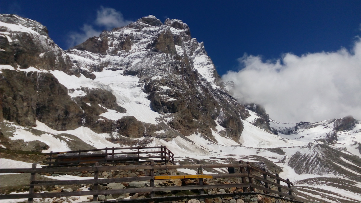
Climbing the Matterhorn — an 8-day guided trip on the 4478 m summit that stands on the Italian–Swiss border. Training and acclimatisation are based in Italy, around Courmayeur and Breuil-Cervinia; the summit stage follows the Hörnli ridge from Zermatt.
- Matterhorn, 4478 m, by the Hörnli ridge
- One guide to one climber
- Acclimatisation on Aiguille d'Entrèves, 3600 m, and Breithorn, 4146 m
- Breithorn climbed by the east ridge as a half-traverse, close to Matterhorn conditions
- Accommodation in hotels and mountain huts, no tents
- One rest day that also serves as the weather reserve
- Certified mountain or alpine guide
Under the safety requirements of the International Federation of Mountain Guides Associations (IFMGA), a guide works with only one participant on this trip. The guide-to-client ratio on our Matterhorn ascents is strictly 1:1, because no other arrangement is considered safe enough on this terrain.
Important:
- The Matterhorn is technically demanding and is not a walking route; it is noticeably harder than Mont Blanc and other popular summits of similar height
- Acclimatisation matters even at this altitude, because any delay or slow progress on the route is highly undesirable and the terrain is poorly suited to physically assisting another person
- This trip is one possible variant; it may be adjusted according to the weather, the state of the route, the participant's actual level of preparation and the availability of places in the mountain huts
- Travel to Courmayeur and back, accommodation and meals in Courmayeur and mountain rescue insurance are not included
- Reaching the summit depends on the weather, the state of the route and the guide's decision
About the Matterhorn ascent
The Matterhorn, 4478 m, stands on the border between Italy and Switzerland, in the heart of the Alps. On the Swiss side, at the very foot of the mountain, lies the village of Zermatt, one of the best known resorts in the region and the point from which the Swiss-side ascent begins. The first ascent was made in 1865, and since then the number of climbers drawn to the mountain has grown steadily.
Climbing the Matterhorn is not straightforward. There is no route here that is open to everyone, so mental and physical readiness matter before you commit to the summit. This trip was built around the specific difficulties a climber meets on the way up. It is run individually: one guide works with one climber rather than with a group. That is deliberate — on the Matterhorn even an experienced guide cannot move a large party both comfortably and quickly, and speed is part of safety here.
Before the summit attempt, participants work on terrain that reproduces the character of the Matterhorn route. Assessing a climber’s real skills correctly is critical. Proper acclimatisation allows the party to move quickly along the route, which in turn makes the ascent safer. The acclimatisation block runs from Courmayeur and Breuil-Cervinia: the Torino hut and Aiguille d’Entrèves, 3600 m, then a night at the Guide del Cervino hut, 3489 m, with an outing to 3900 m, and then Breithorn, 4146 m, climbed by the east ridge as a half-traverse of the massif.
After the training stage the climber moves down to Breuil-Cervinia and, following a short rest, up to a mountain hut near the start of the route. On the confirmed itinerary the summit stage is made from Zermatt: cable car to Schwarzsee, 2552 m, then the walk to the Hörnli hut, 3260 m, and the ascent of the Hörnli ridge the following morning.
This trip should be treated as one of the possible variants. Depending on the weather, the state of the route, the participant’s actual level of preparation and the availability of places in the mountain huts, it may be adjusted.
Fitness and experience. Good physical condition is needed to complete every stage of the trip. Training beforehand is welcome and makes the climb easier. Be ready for an ascent of 10–12 hours with a small pack of about 5 kg and up to 1500 m of ascent. The trip also requires:
- Experience of technically simple ascents at Russian grade 2A–2B
- Experience of ascents or mountain trips to 3500 m and above
- Experience of climbing on rock in mountain boots
- Experience of climbing on rock in crampons
- Experience of ice slopes at 25°–35°
Matterhorn climbing itinerary by the Hörnli ridge, 8 days
Day 1. Arrival.
The most convenient airport for arrival is Geneva; Milan and Turin are alternatives. A transfer takes participants on to Courmayeur, where dinner and the briefing follow. Accommodation in a guest house, hotel or apartment.
Day 2. Preparation, acclimatisation and equipment fitting.
In the morning the climber meets the guide, checks equipment and settles the practical arrangements. A transfer then goes to the Skyway cable car and up to the Torino hut, 3375 m. From there the route continues onto the glacier and up the small rock summit of Aiguille d’Entrèves, 3600 m. In good weather the summit gives a view of Mont Blanc. After the climb comes the return to Courmayeur.
Total walking time: 4–5 hours. Ascent: 575 m. Descent: 575 m.
Day 3. Acclimatisation outing at the Guide del Cervino hut, 3489 m.
Transfer to the Valtournenche valley and the town of Breuil-Cervinia at the foot of the Matterhorn. From there a cable car climbs to the Plateau Rosa top station; the hut is about five minutes’ walk away. After settling in comes an acclimatisation outing to 3900 m and preparation for the following day. Night in a mountain hut.
Total walking time: 3–4 hours. Ascent: 411 m. Descent: 411 m.
Day 4. Breithorn, 4146 m, and return to Courmayeur.
This is the training day before the main ascent. An early start leads onto Breithorn by the east ridge, making a half-traverse of the massif. The route is technically interesting and comes as close as possible to the conditions of the Matterhorn ascent, so it is the best test of readiness for the main objective. After the descent to the hut the cable car runs down to Cervinia, followed by the transfer to Courmayeur.
Total walking time: 6–7 hours. Ascent: 775 m. Descent: 675 m.
Day 5. Rest day, or reserve day.
The day can be used for rest, or held as the reserve in case of bad weather and other unforeseen circumstances.
Day 6. Transfer to Zermatt and walk to the Hörnli hut.
After breakfast the transfer runs to Zermatt in Switzerland. A cable car climbs to the Schwarzsee station, 2552 m, and from there the walking approach leads to the Hörnli hut, 3260 m. Night in a mountain hut.
Total walking time: 2–3 hours. Ascent: 708 m. Descent: none.
Day 7. The Matterhorn, 4478 m, and descent to Zermatt.
The most demanding day of the trip. The start is at about five in the morning, in the dark, and the climbing on difficult rock begins immediately. Snow may lie on the ridge in places, and the summit tower is the most serious section. Judging your reserves correctly is essential, because a long descent follows the summit. After a short rest back at the Hörnli hut the route continues down to Zermatt, followed by the transfer to Courmayeur.
Total walking time: 10–12 hours. Ascent: 1218 m. Descent: 1926 m.
Day 8. Transfer to Geneva and departure.
What's included
- Services of a certified mountain or alpine guide
- All the guide’s expenses related to the itinerary
- Meeting in Courmayeur
- All ground transfers according to the itinerary
- Accommodation in mountain huts
- Meals in the mountain huts — breakfast and dinner
- Cable cars
What's not included
- Travel to Courmayeur and back
- Accommodation in Courmayeur
- Meals in Courmayeur, and in restaurants or cafés in the villages and towns
- Lunches during the walking days. On day walks and ascents a light snack is arranged by the participant; lunch can also be bought in the mountain huts
- Insurance covering the cost of mountain rescue
- Equipment rental
- Tips for the mountain guides — 200 euros per group
- Any costs arising from a change to the itinerary
Private groups
The Matterhorn is run one to one: one guide works with one participant; a version for two experienced climbers is possible only after their preparation has been assessed. Additional training days can be agreed, but acclimatisation cannot be shortened and the route will not be attempted in unsuitable conditions.
Documents you need
- Passport
- The documents you need to enter Italy and Switzerland for your nationality
- Medical insurance covering technical mountaineering above 4400 m, search and rescue and evacuation
- Confirmation of hut and transport bookings
- We recommend keeping digital copies of your documents on your phone and in cloud storage
Weather and seasons
The classic ascents are planned for the summer season, when the huts are open and the route is in suitable condition. On the Matterhorn, dry rock, an absence of fresh snow and acceptable wind matter especially. Even on a confirmed date the guide may call off the climb because of ice, precipitation, thunderstorms or the state of the route.
Accommodation and meals
Town accommodation in Courmayeur or Breuil-Cervinia is chosen and paid for separately unless it is part of your own quote. Mountain huts with shared rooms are used during acclimatisation and the climb; breakfast and dinner in the huts are part of the confirmed trip.
Facilities on the route
- Accommodation in the huts is shared and there is an early lights-out
- Showers, hot water, electricity and charging are limited
- Internet and mobile coverage on the route are unreliable
- You carry your own lunch and personal equipment
- The guide sets the pace on a technical route; dropping behind or pushing ahead on your own is not acceptable
Страхование
НаверхEquipment list for the Matterhorn climb
Скачать PDFTechnical clothing
- Layer 1 (top and bottoms): base layers next to the skin
- Layer 2 (top): fleece, Windstopper or similar jackets
- Layer 2 (bottoms): softshell mountaineering trousers
- Layer 3 (top and bottoms): windproof and waterproof clothing (jacket and trousers) suitable for mountaineering
- Layer 4 (top): a light down jacket with a hood, or an equivalent synthetic jacket, rated to -5 °C
- Thick (warm) and medium-weight socks
- Thin windproof gloves
- Warm gloves rated to -5 °C
- Warm hat
- Buff, bandana, cap or a light hat
Personal items
- A water bottle and/or vacuum flask of 1 litre
- Head torch with at least 12 hours of battery life
- A small personal first-aid kit (for example: blister plasters, cold-sore treatment)
- Sunglasses with UV protection category 3 or 4
- Sun cream and lip balm with SPF 50
- Insurance against accidents in the mountains
For the hut
- Personal toiletries
- Silk or cotton sleeping bag liner
Climbing equipment
- Rucksack of 35-40 litres
- High-altitude boots for 3500-4500 m summits, able to take semi-automatic crampons
- Climbing harness
- Helmet
- Crampons with anti-balling plates
- Ice axe
The guide carries the group climbing equipment (rope, slings, quickdraws, ice screws, nuts and so on), together with a first-aid kit and communication equipment
Вам также будет интересно:
-
 19,000 $
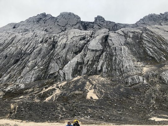
Climb Carstensz Pyramid, 8 Days with Helicopter Access
-
 3,900 $
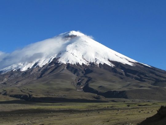
Climb Chimborazo and Cotopaxi — 14-Day Ecuador Expedition
- Height (m)
- 5897, 6384
- Duration
- 11 дней
- Difficulty
- Moderate
- Continent
- South America
- Children
- Ages 14+
- Accommodation
- Hotels only
-
 8,260 $
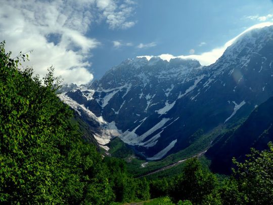
Climb Dykh-Tau by the North Ridge, 13 Days
- Height (m)
- 5204
- Duration
- 13 дней
- Difficulty
- Challenging
- Continent
- Europe
- Children
- Not suitable for children
- Accommodation
- Some nights in tents
-
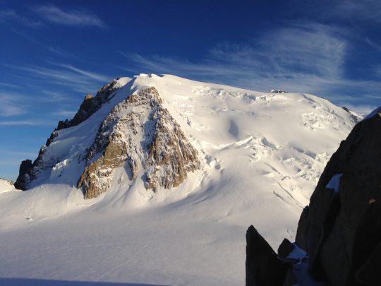 2,960 $
Climb Mont Blanc, 4810 m — 8-Day Guided Ascent