- Guides
- B2B
-
Climbs
-
Climb Elbrus
- Elbrus individually
- Elbrus from the South, 9 days
- Elbrus from the South, 7 days
- Elbrus from the South in 1 day
- Elbrus from the North
- Elbrus Two Summits
- Elbrus Traverse South to North
- Elbrus Traverse North to South
- Elbrus "Cross" from South
- Elbrus "Cross" from North
- Kazbek+Elbrus
- Elbrus from the West
- Elbrus by helicopter
- Elbrus holidays, 9 days
- Elbrus holidays, 7 days
- Tinder Tour: Climbing Mount Elbrus
- Climb Elbrus from the South, 9 days with Sergey Baranov
- Under 5000 m
- 5000+ meters
- 6000+ meters
- 7000+ meters
- 8000+ meters
-
Climb Elbrus
-
Trekking
-
See 8000m
- K2 base camp
- Everest base camp
- Everest base camp via Gokyo
- Everest base camp in a week
- Annapurna circuit
- Trekking the Manaslu Circuit
- Trekking to Kanchenjunga Base Camp
- Trekking to Kanchenjunga Base Camp (Short)
- Trekking to Kanchenjunga Base Camp (India)
- Trekking to Makalu Base Camp
- Trekking to Annapurna BC
- South America
- Asia
- Africa
- Russia
- Europe
-
See 8000m
-
Adventures
-
Africa
- Tour to Morocco for New Year
- Morocco: Toubkal and the mysteries of the Sahara
- Tour to Eritrea: Dahlak Archipelago and Rashaida Nomads
- Tour to Rwanda: Mountain Gorillas and Mount Bisoke
- Ethiopia
- Tour to Uganda: Queen Elizabeth National Park and Mountain Gorillas
- Safari Tanzania
- Safari Uganda
- Tour to Zimbabwe and South Africa: Victoria Falls, Cape Town, and Cape of Good Hope
- Namibia
- Safari Kenya
- Tour to Botswana: Okavango Delta and Chobe National Park
- South America
- Asia
-
Africa
- Ski-touring
- VIP
- Useful
- About
Climb Mont Blanc
- Height (m)
- 4810
- Duration
- 7 days
- Difficulty
- Moderate
- Continent
- Europe
- Children
- From 14 years old
- Accomodation
- Without tents
2690 $
Why to go with us?
Temporarily unavailable
About the tour Ascent to the highest peak of the Alps with preliminary acclimatization to the Breithorn. Preparation and acclimatization for the ascent will take place in Italy in Courmayeur and Broye-Cervigne. To acclimatize, we will spend the night in a hut above three thousand meters and climb the four-thousandth Breithorn. Then there are three […]
НаверхAbout the tour
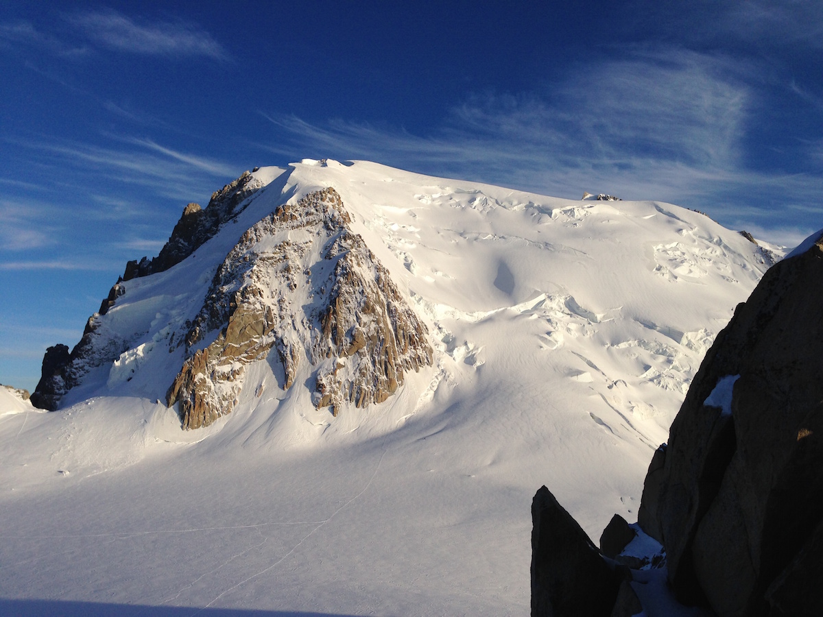
Ascent to the highest peak of the Alps with preliminary acclimatization to the Breithorn. Preparation and acclimatization for the ascent will take place in Italy in Courmayeur and Broye-Cervigne. To acclimatize, we will spend the night in a hut above three thousand meters and climb the four-thousandth Breithorn. Then there are three possible program options. The first involves climbing the classic route through the hut of Goutet from France. The second on the Italian route through the Gonella hut. The third on the route “Through 3 peaks” from France. The choice of the ascent path will depend on the condition of the routes and the availability of free places in mountain huts.
*Due to the fact that the cable cars on the Brighthorn (this is our acclimatization) begin to work in the second half of June, and close no later than mid-September, acclimatization during this period will take place on another mountain.
Physical fitness and experience:
Any healthy person can participate in this program. Training before climbing is always right and good and will make climbing easier, but is not mandatory. Be ready to hike for 6-7 hours with a small backpack weighing about 8 kg with a set heights up to 1000m. It is enough to have experience of simple ascents or mountain hikes to heights of 3000-3500 meters using an ice axe, cats.
Program of guided Mont Blanc ascent (from the French side).
Day 1. Arrival of participants. The most convenient airport for arrival is located in Geneva. Alternatively, you can consider the airports of Milan and Turin. Then transfer to Courmayeur. Dinner and instructing the group. Accommodation in a hotel/hotel/apartment.
Day 2. Preparation for the upcoming ascents, acclimatization and fitting of equipment. Meeting with the guide in the morning. Checking equipment, solving formalities. Transfer to the Skyway cable car. We go up to the hut of Turino (3375m). Then exit to the glaciers and climb to the small rocky peak of Aiguille de Toule (Aiguille de Toule, 3534m). From the top, in good weather, there is a wonderful view of Mont Blanc. Descent to Courmayeur.
Total walking time: 3-4 hours
Climb on foot: 159m
Height drop on foot: 159m
Day 3. Acclimatization exit and classes near the hut “Guides Cervino” (Guide del Cervino, 3489m). Transfer to the Valtournenche Valley to the foot. Matterhorn town of Breuil-Cervinia. From here by cable car to the upper station “Plateau Rosa”. The hut is a 5-minute walk from the cable car. After accommodation in the hut, the acclimatization exit is up to 3900m. Preparing for the next day. Overnight in a mountain hut.
Общее время пешей части пути: 3-4 часа
Набор высоты пешком: 411м
Сброс высоты пешком: 411м
Day 4. Climbing the Breithorn (Breithorn, 4164m). Descent and return to Courmayeur.. Training day before the main ascent of Mont Blanc. Early exit and ascent of the Brighthorn. Technically a simple ascent with a fantastic panorama of the western and central Alps. Descent to the hut and then by cable car down to Cervinia. Transfer to Courmayeur.
Общее время пешей части пути: 4-5 часов
Набор высоты пешком: 675м
Сброс высоты пешком: 675м
Day 5. Rest day before climbing Mont Blanc. Overnight in Courmayeur.
Day 6. Transfer to Chamonix and transfer to the hut of Gute. After breakfast, a short transfer to the French side, where from the town of Les Houches we will go up on the cantata road, and then by mountain tram to the Eagle’s Nest station (Nid d’Aigle, 2372m). From where our pedestrian part of the way will begin. At first, it is not a difficult transition to the Tete Rousse hut, and from here, in bundles, a more difficult ascent over the rocks to the hut of Gute (Gouter, 3835m). Overnight in a mountain hut.
Total walking time: 6-7 hours
Climb on foot: 1458m
Height drop on foot: —
Day 7. Climbing Mont Blanc (Montblanc, 4810 m). Descent to Chamonix. The most responsible and difficult day of the program. We leave at three in the morning, in fact in the dark. At the beginning, along a wide snowy slope that will lead us to the dome of the Dome de Gouter (Dome du Gouter, 4304 m). From here, a small descent and climb again. The final part of the ascent is a narrow and steep snow ridge. By the same route, we descend to the hut of Gute and then to the station of the mountain tram, which will take us down to the cable car. And further down into the valley. Transfer to Courmayeur.
Total walking time: 8-10 hours
Climb on foot: 980m
Height drop on foot: 2423m
Day 8. Transfer to Geneva. Plane back home.
The cost of Mont Blanc ascent doesn’t include:
- The road to Courmayeur and back;
- Accommodation in Courmayeur;
- Meals in Courmayeur. In populated areas in restaurants or cafes;
- Lunch during the transitions. During the day trips and ascents, a light snack (organized independently), there is an opportunity to buy lunch in mountain huts;
- Insurance covering the cost of rescue work in the mountains;
- Equipment rental;
- Tips by a mountain guide (200 Euros per group);
- Any costs caused by the changing of the programs.
Insurance
НаверхEquipment.
Скачать PDFSpecial clothing
- 1st layer (top and bottom): thermal underwear
- 2nd layer (top): fleece, windstopper or anthological jackets
- 2nd layer (bottom): softshell pants for mountaineering
- 3rd layer (top and bottom): wind- /moisture-proof clothing (jacket and pants) suitable for mountaineering
- 4th layer (upper): lightweight down or similar synthetic jacket for temperatures up to -15°C
- Thick (warm) and medium-thick socks
- Thin gloves windproof gloves
- Warm gloves for temperatures up to -15°C
- Hat
- Buff, bandana, cap or light cap
Personal items
- Flask and/or thermos with a volume of 1L
- Headlamp
- Personal mini first aid kit (for example: a patch for corns, cold remedies on the lips)
- Sunglasses with UV protection factor 3 or 4
- Sunscreen and hygienic lipstick with UV protection factor 50
- Insurance against accidents in the mountains
For the hut
- Personal hygiene products
- Hygienic liner in a sleeping bag made of silk or cotton
Climbing equipment
- Backpack with a volume of 35-40L
- Alpine boots for climbing 4000-5000m with the possibility of fixing semi-automatic
- crampons
- Safety system
- Helmet
- crampons with an anti-clip
- Ice axe
The guide will have with him public climbing equipment (rope, loops, braces, ice drills, stoppers, etc.), as well as a first aid pharmacy and means of communication
You may also like
-
 3,590 $
Climb Elbrus from the West
-
 1,600 $
Climb Kazbek, South
-
 4,490 $
Climb Matterhorn
-
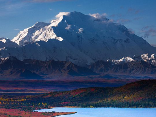 18,690 $
Climb Denali (Mc.Kinley)
- Height (m)
- 6193
- Duration
- 21 day
- Difficulty
- Average
- Continent
- North America
- Children
- No
- Accomodation
- There are tents