- Guides
- B2B
-
Climbs
-
Climb Elbrus
- Elbrus individually
- Elbrus from the South, 9 days
- Elbrus from the South, 7 days
- Climb Elbrus with Oxygen
- Elbrus from the North
- Elbrus Two Summits
- Elbrus Traverse from South to North, 9 Days
- Elbrus Traverse from North to South, 10 Days
- Elbrus "Cross" from South
- Elbrus "Cross" from North
- Kazbek+Elbrus
- Elbrus from the West
- Elbrus by Private Helicopter, 3 Days
- Elbrus Region Holiday and Trekking, 9 Days
- Elbrus Region Holiday, 7 Days
- Elbrus Dating
- Climb Elbrus from the South, 9 Days with Sergey Baranov
- Under 5000 m
- 5000+ meters
- 6000+ meters
- 7000+ meters
- 8000+ meters
-
Climb Elbrus
-
Trekking
-
Trekking in Nepal: routes to the eight-thousanders
- K2 base camp
- Everest base camp
- Everest base camp via Gokyo
- Everest base camp in a week
- Annapurna Circuit and Tilicho Lake Trek
- Manaslu Circuit Trek
- Kanchenjunga Circuit Trek (XXL)
- Kanchenjunga North Base Camp Trek (Short)
- Kanchenjunga from India: the Goecha La Trek in Sikkim
- Makalu Base Camp Trek
- Annapurna Base Camp Trek
- Trekking in South America
- Asia
- Trekking in Africa
-
Trekking in Russia
- Elbrus Region Holiday and Trekking, 9 Days
- Elbrus Region Holiday, 7 Days
- Oshten + Kardyvach — 9-Day Western Caucasus Trek
- Lake Kardyvach — 5-Day Base-Camp Trek
- Route 30: Through the Mountains to the Sea, with Oshten — 4 Days
- Trekking in Arkhyz — 7 Days over the Ayulyu Pass
- Gvandra Trek — 7 Days to the Ullu-Kyol Lakes
- Trekking in Dombai — 7 Days with the Murudzhu Lakes
- Europe
-
Trekking in Nepal: routes to the eight-thousanders
-
Adventure expeditions
-
Trekking in Africa
- Tour to Morocco for New Year
- Morocco: Toubkal and the mysteries of the Sahara
- Eritrea: the Dahlak Archipelago and the Rashaida Nomads
- Rwanda: Mountain Gorillas and the Bisoke Volcano
- Ethiopia: Otherworldly Landscapes and the Peoples of the Omo Valley
- Tanzania Safari: Serengeti, Ngorongoro and Tarangire
- Zimbabwe and South Africa: Victoria Falls, Cape Town and the Cape of Good Hope
- Namibia: Etosha National Park and the Himba
- Kenya Safari: the African Big Five
- Trekking in South America
- Asia
-
Trekking in Africa
- Ski touring and ski mountaineering: chasing freedom in the mountains
- VIP tours
- Useful
- About
K2 Base Camp Trek via the Gondogoro La
- Height (m)
- 5700
- Duration
- 18 days
- Difficulty
- High
- Continent
- Asia
- Children
- Ages 14+
- Accommodation
- Some nights in tents
3700 $
Why to go with us?
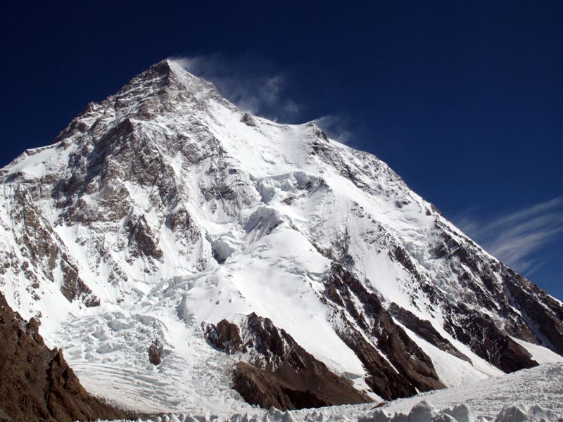
The trek to K2 Base Camp over the Gondogoro La is one of the fullest and hardest walking routes in the Karakoram. Over eighteen days the group crosses the Braldu valley and the Baltoro Glacier, sleeps at the foot of K2, returns to Concordia and crosses the Gondogoro La, finishing in the Hushe valley.
This is a trip for physically prepared participants with experience of multi-day walking and of altitude. The key stage is done in crampons, in a harness and on fixed ropes. The guide helps to control the pace, the acclimatisation and the work with the local team, but participants must learn to use the agreed technical equipment beforehand.
The price includes the domestic flight in the itinerary, and a night is provided at K2 Base Camp. The route lets you see K2, Broad Peak and the Gasherbrum group from different points without returning down the Baltoro by the same way.
Important. The price is fixed in US dollars. The Gondogoro La crossing, and reaching any high point, depend on the weather, on the state of the snow and ice and on the guide's decision. Mountain Guide does not sell air tickets and does not arrange visas.
About the K2 Base Camp trek
The route to K2 Base Camp runs through Baltistan, the northern region of Pakistan from which expeditions set out for the central Karakoram. After Islamabad and Skardu the group reaches Askole, walks the valley of the Braldu river and moves onto the Baltoro Glacier. The camps then rise in sequence to Concordia, the junction point from which K2 and the surrounding peaks open up.
The trip differs from the classic out-and-back trek to Concordia. Participants continue along the Godwin-Austen Glacier to K2 Base Camp, spend a night there, then return to Concordia and move on to Ali camp. The final part crosses the Gondogoro La at about 5600 m and descends into the green Hushe valley. Built this way, the route shows both the severe glacial basin of the Baltoro and the other side of the Karakoram, without repeating the whole way back to Askole.
The main difficulty is the combination of prolonged self-sufficiency, several nights above 4000 m, movement over moraine and glacier, and a technical pass crossing. The Gondogoro La day starts early and involves a large gain and loss of altitude. On the fixed ropes you need crampons, a harness, a cow’s tail and the ability to act without haste. This is not a first trip to the mountains and it is not an alternative to an ordinary sightseeing tour.
Acclimatisation is built into the route itself: altitude is gained gradually, a rest day is provided at Paiju, and the night at K2 and the return to Concordia precede the move to Ali camp. That schedule helps adaptation but does not rule out altitude sickness. The guide monitors the condition of the group and may change the tactics or turn a participant back.
Accompaniment matters most in the stage of preparation for the pass: the guide explains the order of movement, relays the local team’s instructions and helps to check equipment. At the same time, individual physical preparation, suitable kit and insurance covering high-altitude trekking and evacuation remain the participant’s responsibility.
Itinerary of the guided trek to K2 Base Camp
Day 1. Arrival in Islamabad.
A team representative meets the group at the airport and arranges the transfer to the hotel. In the afternoon there is the compulsory briefing at the Pakistan Ministry of Tourism, followed by an introduction to the guide and the other participants, a check of documents and a briefing. This day exists to complete the formalities and to resolve any equipment problems before the flight to Skardu. Night at a hotel.
Day 2. Flight to Skardu.
The group flies from Islamabad to Skardu. On arrival we check into a hotel and prepare the baggage for the drive into the mountains. Skardu is the last major logistical point on the route, so the guide checks the distribution of personal and group loads again. Night at a hotel.
Day 3. Drive to Askole, 3050 m.
In four-wheel-drive vehicles we travel through the Shigar and Braldu valleys to Askole. The drive takes about six to seven hours. In the village we meet the porters, distribute the baggage and prepare for the self-supported part of the route. The task of the day is to reach the start of the trek without additional walking and to agree how the whole trekking team will work. Night in tents.
Day 4. Askole to Jhula, 3300 m.
The first stage follows the Braldu river through Korophon to the Jhula camp. A calm start allows everyone to check footwear, pack and pace before moving onto harder glacial ground. The gain in altitude is about 250 m, the distance about 12 km and the time on the trail about five hours. Night in tents.
Day 5. Jhula to Paiju, 3580 m.
We walk over hilly ground and in places along a narrow trail above the river. As we progress, the first views of the Baltoro Glacier, the Cathedral Towers and the peaks of the central Karakoram open up. The long stage works towards gradual acclimatisation before moving onto the glacier. The gain in altitude is about 280 m, the distance about 18 km and the time on the trail about seven hours. Night in tents.
Day 6. Rest and acclimatisation at Paiju, 3580 m.
We stay at the Paiju camp. Participants recover after the first stages, dry their kit, monitor how they feel and prepare equipment for several days of moving over moraine and glacier. For the porter team this is also a day of preparing loads and provisions for the next part of the route. Night in tents.
Day 7. Paiju to Khoburtse, 3900 m.
We move onto the Baltoro Glacier and continue over stone-covered moraine. The route demands constant attention on uneven ground; along the way Paiju Peak, Uli Biaho and the Trango Towers open up. The camp lies at the edge of the glacier. The gain in altitude is about 320 m, the distance about 14 km and the time on the trail about seven hours. Night in tents.
Day 8. Khoburtse to Urdukas, 4050 m.
We continue over moraine to Urdukas. A short stage by comparison with the previous day reduces the cumulative load and gives the body time to adapt to a night above 4000 m. The gain in altitude is about 150 m, the distance about 6 km and the time on the trail about three hours. Night in tents.
Day 9. Urdukas to Goro, 4380 m.
We descend to the central part of the glacier and move towards the Goro camp. Masherbrum and Gasherbrum IV open up along the route. A night on the glacier means colder and windier conditions, so after the stage it is important to change into dry clothing at once and rehydrate. The gain in altitude is about 320 m, the distance about 11 km and the time on the trail about five hours. Night in tents.
Day 10. Goro to Concordia, 4650 m.
We climb to Concordia, the confluence of the great glaciers of the central Karakoram. As we approach, K2, Broad Peak, Gasherbrum IV, Chogolisa and other peaks open up. This camp becomes the base for the walk out to K2 and for the onward move to the Gondogoro La. The gain in altitude is about 270 m, the distance about 15 km and the time on the trail about six hours. Night in tents.
Day 11. Concordia to K2 Base Camp, 5100 m.
Early in the morning we set out along the Godwin-Austen Glacier to K2 Base Camp. Sections of meltwater and difficult moraine are possible on the approach, so the pace is set by the guide. After making camp, and if time and safe conditions allow, it is possible to walk to the Gilkey memorial. A night at 5100 m is an important altitude stage before the return to Concordia and the pass crossing. The gain in altitude is about 450 m, the distance about 12 km and the time on the trail about five hours. Night in tents.
Day 12. K2 Base Camp to Concordia, 4650 m.
We return along the familiar glacial route to Concordia. Losing altitude after the night at K2 aids recovery, but the moraine crossing still demands attention. On arrival we rest and prepare the technical equipment for Ali camp. The descent is about 450 m, the distance about 12 km and the time on the trail about four hours. Night in tents.
Day 13. Concordia to Ali camp, 4800 m.
We move to Ali camp on the approaches to the Gondogoro La. After making camp the guide carries out the compulsory check of crampons, harness, cow’s tail and descender, and goes over the order of movement on fixed ropes again. A short stage is needed to conserve strength before an early and technically demanding crossing. The gain in altitude is about 150 m, the distance about 10 km and the time on the trail about four hours. Night in tents.
Day 14. Ali camp to the Gondogoro La, 5600 m, to Khuspang, 4600 m.
We set out at night in order to cross the pass in more stable conditions. A substantial part of the key section is done in crampons, on belay and on fixed ropes. Whether the crossing is possible is decided by the guide according to the weather, the state of the snow and ice and the readiness of participants; reaching the pass is not guaranteed. After the high point we descend into the Khuspang valley. The gain in altitude is about 800 m, the descent about 1000 m, the distance about 10 km and the time on the trail about nine hours. Night in tents.
Day 15. Khuspang to Saicho, 3350 m.
We continue down the Gondogoro valley through pastures and moraine terrain. The substantial loss of altitude aids recovery after the pass, but fatigue calls for a careful pace all the way to camp. The descent is about 1250 m, the distance about 16 km and the time on the trail about six hours. Night in tents.
Day 16. Walk to Hushe and drive to Skardu.
We walk about three hours to Hushe, where the walking part of the route ends. We then drive in four-wheel-drive vehicles to Skardu; the road takes about six to eight hours. At the hotel participants recover after the self-supported part, sort out their kit and prepare their baggage for the flight. Night at a hotel.
Day 17. Flight to Islamabad.
The group flies from Skardu to Islamabad and checks into a hotel on arrival. The day separates demanding mountain logistics from the international departure and is used for rest and for preparing documents and baggage. Night at a hotel.
Day 18. End of the trip.
At the agreed time there is a transfer to Islamabad airport. Participants check in for the international flight independently. The departure time is set by the schedule and the margin required before departure.
What's included
- A Mountain Guide team leader
- Meeting and seeing off at the airport
- Two nights in Islamabad in a hotel with breakfast
- Two nights in Skardu in a hotel with breakfast
- Transport Islamabad – Skardu – Islamabad
- Jeeps Skardu – Askole (Hushe) – Skardu
- Wages for the local guide, the cook and the porters on the trek
- Local taxes and insurance for the guides and porters
- Meals on the trek – breakfast, lunch and dinner
- Mules and porters to carry group and personal baggage up to 12 kg
- Road and bridge crossing fees
- The compulsory briefing and debriefing at the Pakistan Ministry of Tourism
- All the necessary papers and permits
- Tents and sleeping mats on the trek
- Airport – hotel – airport transfers
What's not included
- International flights
- Medical insurance and the cost of rescue work. The policy must include helicopter cover, with a helicopter evacuation sum insured from $40,000; a helicopter in Pakistan costs $37,000.
- A Pakistan visa
- Lunches and dinners in the cities
- Tips for the team
- Any costs connected with political instability and natural disasters
- Any costs connected with change to the itinerary
Private groups
The trek can be arranged for a closed group of friends, a club or a corporate team, with no one else joining. Dates, the make-up of the guiding team and any extra services available on the route are agreed individually. A private group can discuss their own dates within the working season, separate transport, single rooms in the towns and extra help carrying personal baggage. The language the group is led in and the make-up of the team are confirmed before booking. The route remains self-sufficient and high-altitude. Adjustments must not remove acclimatisation days, compulsory permits or the time needed to get back safely. The price depends on the number of participants, the dates you choose, the make-up of the team and any extra services confirmed.
Documents you need
Document requirements depend on your nationality and can change. Check them before you buy non-refundable tickets, and again before you fly. The first name and surname on every booking must match the spelling in your passport exactly. Mountain Guide does not sell air tickets and does not arrange entry visas, but it does provide the booking confirmations it holds and the documents issued by the host team.
Documents
- A valid passport
- A visa or other entry permit for Pakistan, if one is required for your nationality
- International and domestic air tickets, or e-ticket receipts, for the trip
- Medical insurance covering high-altitude trekking, a maximum altitude of at least 5600 m, search and rescue and emergency evacuation
- Your insurance policy number and the insurer’s 24-hour emergency contact details
- Your booking confirmation for the trip and the organisers’ contact details
- Passport copies and photographs in the format the host team requests for trekking permits
- Documents for a participant under 18, where these apply
- Digital copies of your passport, visa, tickets and insurance on your phone and in cloud storage
- Waterproof wallet for your original documents
The documents needed for local permits, and the deadline for sending them, are confirmed for each departure. Carry the originals of your passport, insurance and permits in your hand luggage.
Weather and seasons
Trekking in the Karakoram takes place in summer, when the route to the Baltoro and the high camps is normally open to organised groups. Specific dates are confirmed once permits, roads, bridges and the local team’s availability have been checked. The valleys can be hot and dusty, while the glacier, Concordia and the base camps can bring cold wind, rain, snow and sub-zero night temperatures. The weather and the state of the glacier can change the group’s pace considerably. The internal flight, the mountain roads and the jeep transfers all depend on actual conditions. Buy international tickets leaving time in hand after the planned return. The guide may change the start time or shorten a stage for safety, but such decisions do not automatically extend the trip.
Accommodation and meals
Hotel accommodation with breakfast is provided in Islamabad and Skardu for the number of nights in the itinerary. Standard accommodation, a single room and extra nights should be checked against your trip confirmation. On the trekking section the group lives in tents. Tents and sleeping mats are included in the price, but you bring your own sleeping bag and the rest of the equipment on the list. The camps are a long way from any town comforts, so think of the accommodation as an expedition camp. Three meals a day are provided on the trek, with a cook and the kitchen equipment needed. Lunches and dinners in the towns are paid separately. Food allergies, a vegetarian diet and medical restrictions must be reported before booking. Which substitutions are possible depends on self-sufficient logistics and is confirmed by the host team.
Facilities on the route
Showers and toilets. The hotels have the usual town facilities. On the camping section the washing arrangements are those of a field camp; a hot shower is not guaranteed. Toilet arrangements are made by the host team according to the campsite.
Power and charging. You can charge devices reliably in the towns. Access to electricity is limited on the trek, so you need a power bank, spare battery packs and separate batteries for your torch.
Internet and phone signal. After leaving Skardu, mobile signal and internet are unreliable and may be absent for long stretches. How the group will stay in contact is confirmed before the trip.
Laundry and drying. There is no regular laundry on the route. You need a supply of dry underwear and socks, a quick-drying towel and dry bags for clothing and electronics.
Baggage. The baggage limit carried for you is given under “What’s included”. You carry your own day pack with water, warm clothing, waterproofs and personal items.
Insurance
Show insurance calculator (Russian)
This calculator is provided by an external provider and uses a Russian-language interface.
Equipment list for the trek to K2 Base Camp (crossing the pass).
Download PDFYou bring all of your own personal equipment. Before the trip, agree your footwear, sleeping bag and personal kit with the guide, taking the season and the conditions on the route into account.
Documents
- Passport
- Air tickets or e-ticket receipts
- Medical insurance covering the stated activity and the maximum altitude of the trip
- The embassy’s application form, completed in English (3 copies)
- 4 colour photographs, 3×4 cm
- Copies of your passport
- We recommend keeping digital copies of your documents on your phone and in cloud storage
Personal equipment
- Rucksack of 50-60 litres
- A sleeping bag with a comfort rating of -10 °C
- Trekking poles, which must have baskets of at least 70 mm
- Crampons
- Classic ice axe with a steel pick, or a technical ice tool
- Climbing harness
- 5 karabiners
- Cow’s-tail lanyards
- Descender
Clothing and footwear
- Single-layer mountaineering boots
- Trainers (for the towns)
- Waterproof shell: jacket and trousers. The market runs from simple 5,000/5,000 membranes through to Gore-Tex garments
- Fleece top and bottoms
- Base layer, top and bottoms
- Down jacket with a hood
- Warm mittens
- Thick gloves
- Thin gloves
- Bandana (as well as sun protection in the valley, it can keep your throat or face warm in the cold)
- Warm hat
- Warm trekking socks for summit day
Other items
- LED head torch with at least 12 hours of battery life
- Sunglasses
- Ski goggles
- Vacuum flask, 1 litre. Preferably without a push-button lid
- Windproof mask for the lower face
- Gaiters
- Sun cream and lip balm
- Chemical hand warmers (not compulsory, but they can be very useful)
- Personal first-aid kit
- Elastic bandage and/or a support brace
You may also like
-
 39,000 $
Climb Broad Peak, 8051 m — 51-Day Karakoram Expedition
- Height (m)
- 8051
- Duration
- 51 day
- Difficulty
- Challenging
- Continent
- Asia
- Children
- Ages 14+
- Accommodation
- Some nights in tents
-
 39,000 $
Climb Gasherbrum I and II — 50-Day Karakoram Expedition
- Height (m)
- 8034, 8080
- Duration
- 61 day
- Difficulty
- Average
- Continent
- Asia
- Children
- Not suitable for children
- Accommodation
- Some nights in tents