The weather on Kilimanjaro changes first and foremost with altitude, time of day and which side of the massif you are on, and only after that with the calendar month. In the course of a single climb you pass from warm, humid forest to open high ground, a cold summit camp and the summit zone at 5895m. A forecast for Moshi therefore answers none of the questions that matter: what will happen on the stage you are walking, in your particular camp, and during the night ascent.
The season helps you judge the likelihood of rain, cloud and good visibility, but it does not determine the weather of any given week. Even in the popular dry months you can meet precipitation, strong wind and snow, and in the rainy season there are clear windows. Sound preparation is built not around the promise of a perfect forecast but around being ready to keep your dry clothing dry, adjust your layers and follow the guide’s decisions when conditions change.
The commonest mistake is to prepare only for the lowest temperature. In practice, overheating in the forest, wet clothing, sunburn, dust and sudden chilling at a stop cause just as much trouble.
The short answer: what weather to expect at each altitude
| Section | Typical characteristics | What changes fastest | Your practical task |
|---|---|---|---|
| Moshi and the drive to the gate | Warm, sun, cloud or tropical rain | Rainfall and humidity | Avoid overheating and keep waterproofs within reach |
| Montane forest, roughly 1800-3000m | Humid air, wet vegetation, mud and limited visibility | The intensity of the rain and the state of the trail | Keep your sleeping bag and warm kit dry |
| Heath and camps at around 3000-4000m | Sun, wind, cloud and rapid chilling once you stop | How the temperature feels | Adjust layers before you overheat or start shivering |
| Open high ground, roughly 4000-4800m | Dry air, strong sun, dust, cold wind, possible precipitation | Wind, cloud and visibility | Protect your face, eyes, hands and water supply |
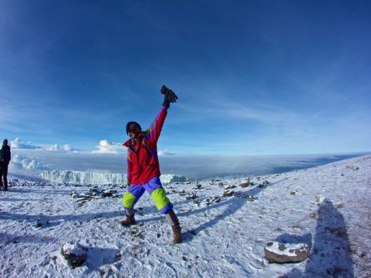
| Summit night, roughly 4700-5895m | Frost, darkness, wind, snow or graupel depending on conditions | Wind chill and the state of the surface | Stay warm, hold a workable pace and keep something in reserve for the descent |
This is not an hourly forecast, nor a promise of any particular temperature. The altitude bands are approximate and the actual conditions depend on the route. Barafu camp on the tented routes and Kibo hut on Marangu, for example, sit at comparable altitudes but differ in aspect, terrain and the kind of accommodation they offer.
Why Kilimanjaro makes its own weather
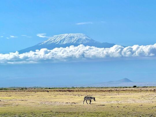
Kilimanjaro is an enormous free-standing massif. Humid air rises up its slopes, cools, and forms cloud and precipitation, but the process is not the same on every side. The southern and eastern slopes are usually wetter, while the northern side lies in a relative rain shadow. You can see the difference in the vegetation, the state of the trail and the character of the cloud.
Scientific observation shows that mean temperature across the full altitude profile falls by roughly 6.1°C for every 1000m. That figure explains the scale of the transition from the plains to the summit, but it does not let you work out the temperature in your tent by simple subtraction. Cloud, wind, humidity, solar heating, terrain and time of day all create large local differences.
Rainfall does not decrease evenly with every metre either. Kilimanjaro National Park material notes that it increases up to the middle of the montane forest at around 2500m and starts to fall off above that. So the forest can stay wet and misty while the high camp is dry and windy. The reverse also happens when a front passes through or it snows locally.
The daily cycle: why morning, afternoon and night feel so different
Kilimanjaro lies close to the equator, so seasonal changes in day length are small, while the daily cycle is pronounced. At night the open ground loses heat quickly. After sunrise the dark volcanic surface warms up, air movement increases and cloud can build on the slopes. That is exactly why a clear view of Kibo in the morning is no guarantee of the same visibility in the afternoon.
A study of mountain circulation on Kilimanjaro found that the ground above the tree line warms strongly by day and cools at night, and that during daylight hours moisture is carried up from the lower slopes. For the climber this turns into a familiar sequence: a cool start, rapid warming in the sun, wind and cloud in the middle of the day, then a sharp chill once you stop.
It is a pattern, not a timetable. Sometimes the cloud arrives in the morning and a clear window opens in the evening. The guide chooses the start time in the light of the length of the stage, the current forecast and the state of the group, but cannot control the cloud. You need to be able to add or remove a layer within a minute or two, rather than waiting for a general halt.
Montane forest and the first camps: the problem is damp, not cold
Lemosho, Machame and Marangu begin the walking part in humid montane forest. Rongai starts on the northern slope, drier in overall character, but rain is possible there too. In the forest your clothing gets wet from more than a downpour. Moisture sits on leaves and branches, collects on the outside of your pack, transfers to your trousers from the vegetation and to your boots from the muddy trail.
Warm air tempts you to put on too much and soak yourself in your own sweat. A workable system starts with a light base layer and ventilation. Put your shell jacket on before your clothing is thoroughly wet, but open the vents if you start to cook. Your down jacket and dry sleeping kit stay sealed in dry bags.
On the first evening people often underestimate how quickly they cool down after moving. While the group is walking, your body produces plenty of heat. Once you stop, damp clothing turns cold fast. So in camp you put on your dry layer and insulation first, and only then deal with your duffel, the tent and photographs. Hoping to dry heavy boots out completely overnight generally does not work.
Camps at around 3000-4000m: sun, wind and a cold evening
Once you leave the forest the landscape opens up. On Lemosho and Machame that means the Shira plateau, on Marangu the leg up to Horombo, on Rongai the northern heath. Direct sun can feel almost like summer, but cloud and wind change that within minutes. At one stop you take your jacket off; at the next you put it back on.
It is particularly important here to separate air temperature from how warm you feel. A damp back, strong wind and fatigue chill you faster than any thermometer suggests. At the same time ultraviolet radiation stays intense even when the air is cool. Sunglasses, lip protection and sunscreen are needed before you burn, not afterwards.
At night the temperature in tent or hut drops. The huts on Marangu keep out rain and wind better than thin tent fabric, but they do not turn into a heated hotel. A sleeping bag and dry sleepwear are essential in either format. Rest is spoiled not only by cold but by a damp sleeping bag, cramped packing, noise and hunting for kit late at night.
The high camps: open ground and rapid change
Above roughly 4000m there is little vegetation and the terrain offers almost no shelter from the wind. On Lemosho and Machame the team passes the Lava Tower area, Barranco, Karanga and Barafu. Marangu leads out onto the saddle between Mawenzi and Kibo. Rongai approaches Mawenzi and then crosses the open saddle to Kibo.
On a clear day the dark volcanic ground heats up while the air stays cool. After sunset the heat disappears quickly. Dust gets into zips, charging ports and lenses, and the cold reduces battery capacity. Cloud can hide the landmarks, snow or graupel can change the surface of the trail, and wind can lengthen a stage.
By the high camp you are already carrying accumulated fatigue and the effects of altitude. You cannot judge the weather simply by how handsome the summit looks from your tent. The guide weighs up several factors at once: wind, precipitation, visibility, the state of the surface, the team’s speed and the forecast for the time of the descent. Even a clear sky does not rule out a turnaround if the pace is unsafe or someone’s condition worsens.
Summit night: frost is only part of the problem
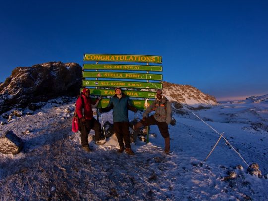
The summit push starts at night from Barafu, Kibo or whichever high camp your programme confirms. The coldest period usually falls in the hours before dawn. You are moving slowly because of the altitude, so you generate less heat than on a brisk daytime stage. Stops feel especially harsh.
It is wrong to name one “normal” temperature for the summit. How it actually feels depends on wind and humidity, and instrument readings vary from day to day. You may meet frozen scree, soft snow, graupel or a dry, dusty trail. Neither the amount of snow nor a view of the glaciers is guaranteed by the month or by an attractive photograph in a forecast.
Your insulation has to work both while moving and at a short halt. Your gloves have to let you manage poles, a bottle and zips. A face mask or neck gaiter protects your face without impeding your breathing. Your water must not freeze somewhere unreachable in your pack. After you reach the crater rim and Uhuru Peak at 5895m there is a long descent to come, often in full sun, so some of those layers have to come off again.
How the weather differs at the main Mountain Guide camps
| Route and section | Altitude per the current programme | What to bear in mind |
|---|---|---|
| Lemosho – Shira 2 | 3810m | Open plateau, sun and wind; colder as soon as you stop |
| Lemosho – Lava Tower and Barranco | A climb to roughly 4360m, sleeping at about 4000m | Altitude, aspect and how the temperature feels all change in a single day |
| Machame – Shira and Barranco | About 3800m and 3900m | Cloud and wind on the open sections, possible damp after the south-western forest |
| Machame – Barafu | About 4800m | An exposed high camp, a cold evening and preparation through the night |
| Marangu – Mandara and Horombo | About 2700m and 3720m | The transition from humid forest to open heath; huts do not cancel the cold |
| Marangu – Kibo | About 4700m | A dry saddle, wind and an early rest before the night start |
| Rongai – the northern approach and Mawenzi | As per the programme for your date | Drier on average than the southern slopes, but rain, cloud and snow remain possible |
The altitudes are taken from the current Mountain Guide programme pages and should be checked again before departure. They explain the character of the conditions but give no hourly temperature. Two camps at similar altitudes can differ because of wind, cloud, the shelter the terrain offers and the time the group arrives.
Dry and rainy months: what the season really changes
TANAPA names June-October and December-March as the popular periods, when clear skies are more frequent. April and May belong to the long rains, and the short rains are usually associated with October-November. These boundaries are not a switch: the rains start and finish earlier or later, and any given week can differ from the long-term picture.
In the rainy period the main difficulties are wet forest, a muddy trail, harder drying and cloud. Even so, the official material does not declare the mountain closed: the climb is possible with the right clothing and equipment.
A dry season does not mean a guaranteed dry week. On a mountain this size precipitation is possible all year round, and the summit zone stays cold regardless of the heat down in Tanzania. Rongai can be a sensible option for a wetter period thanks to its northern approach, but it must not be sold as a route without rain.
How to read a forecast before you set off and on the route
A regional forecast shows the general situation for the Kilimanjaro region, but it is no substitute for one by altitude. The Tanzania Meteorological Authority publishes national and regional forecasts. For the mountain itself, data by altitude and the most recent updates are also taken into account, because accuracy falls away the further ahead you look.
It pays to look not at a single icon but at a set of indicators:
- The temperature at camp altitude and on the section you expect to walk
- Wind speed and direction, not just the maximum gust
- The probability, type and amount of precipitation
- Cloud and visibility during the hours you will be moving
- How conditions change between the ascent and the long descent
One favourable forecast screen is no reason to lighten the compulsory kit. The decision to start and to continue rests with the guide, based on current information. If the forecast worsens, the start may be brought forward, put back or called off. If the forecast is good, the checkpoints on time and on how people feel still apply.
Be especially careful with figures calculated for a single geographical point. In one day the route changes altitude and works its way around the terrain, while a phone app may be showing the nearest town, an airport or an averaged model cell. Check the name of the location, its altitude, the time zone and when the data was last updated. A forecast for the coming night is usually more useful than a handsome ten-day table drawn up before you flew to Tanzania.
You are not expected to make meteorological decisions yourself, but it helps to understand the logic behind them. If rain is expected, the group protects its sleeping bags in advance and sets off with shells to hand. In strong sun, protection goes on from the morning. Ahead of a cold wind, insulation is put on while you are still somewhere sheltered. That kind of preparation saves the whole team time and lets the guide concentrate on the route and on how people are doing.
Once you reach camp, check the forecast against reality. Close the tent before the rain arrives, keep wet things away from dry ones, and get your summit kit ready before dark. If frost is expected overnight, stow water, batteries and boots where they will still be usable in the morning. Weather becomes manageable not because you guessed it correctly but because the essential actions were thought through in advance.
How to build a clothing system for the full range of conditions
Preparing for the weather is a matter of layers. The base layer moves moisture away, the mid layer insulates, the outer layer keeps out wind and precipitation. Separate heavier insulation is kept for camp and for summit night. Such a system lets you change one element instead of choosing between a T-shirt and all your winter clothing.
Your day pack holds waterproofs, light insulation, gloves, sunglasses, face protection and anything you will need before the next camp. A porter is not walking beside you every minute, so a jacket sent off in the duffel is out of reach until you make camp. Your sleeping bag, spare clothing, electronics and documents each get their own inner waterproofing.
Test new boots, shells and gloves before you get to Tanzania. A downpour in the forest and summit night are not the place for a first trial. The whole system is set out in the article on equipment for Kilimanjaro, and the final list is determined by the page for your chosen tour and by the pre-departure briefing.
How to use the weather when choosing a route
You cannot choose a route with guaranteed good weather. You can choose the side of the massif, the duration and the style of accommodation that best fit the month and your own expectations. Lemosho and Machame give you humid forest and southern panoramas, Rongai starts on the drier northern side, Marangu offers huts, and the Northern Circuit stays longer on the remote northern slopes.
For most people the acclimatisation profile matters more than trying to guess one sunny day. Extra time on the mountain does not improve the forecast, but it does give you more scope to move at a sensible pace and recover. You can compare the length and the logic of the main programmes on the page for Kilimanjaro climbs.
Next step: choose your route by season, number of days, accommodation and acclimatisation, then prepare your clothing for the full range of conditions. If you want your own dates and your own pace, a private Kilimanjaro climb is available.
Sources and date checked
The climate information was checked on 3 August 2026. Official seasonal descriptions give a long-term picture, not a forecast for any particular departure.
- Kilimanjaro National Park Special Edition – altitude, rainfall and ecoclimatic zones
- Journal of Animal Ecology – the altitudinal temperature gradient and the rainy seasons
- Global and Planetary Change – mountain circulation and diurnal variation
- Tanzania Meteorological Authority – regional forecasts
What to read next
Kilimanjaro climbing programmes